Canape Capatárida geodata
Canape Capatárida (Falcón) is a seat of a second-order administrative division; located in Venezuela in America/Caracas (GMT-4) time zone. In our database, there are 108 cities with bigger population. Compared to other cities in Venezuela, 97.5% of cities are located further ↓South; 74.8% of cities are located further →East and 84.7% of cities have higher elevation than Canape Capatárida. Note1


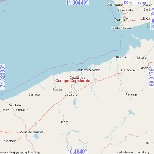
Canape Capatárida GPS coordinates[2]
11° 10' 31.8" North, 70° 37' 14.592" West
| Map corner | latitude | longitude |
|---|---|---|
| Upper-left | 11.86446°, | -71.32385° |
| Center: | 11.1755°, | -70.62072° |
| Lower-right: | 10.4849°, | -69.9176° |
| Map W x H: | 153.4×153.4 km | = 95.3×95.3mi |
| max Lat: | 11.94788° ⇑2.5% North |
| Canape Capatárida: | 11.1755° |
| min Lat: | ⇓97.5% South 1.92027° |
| min Long | Canape Capatár | max Long |
| -72.55212° | -70.62072° | -60.99778° |
| W 25.2%⇐ | ⇒74.8% E |
Elevation
Elevation of Canape Capatárida is 32 m = 105 ft, and this is 348.6 m = 1144 ft below average elevation for this country.
| Max E: |
2986 m = 9797 ft | 84.7% |
| Avg. | 380.6 m = 1249 ft | |
| Canape Capatárida | 32 m = 105 ft | |
Min E: |
-4 m = -13 ft | 15.3% |
See also: Venezuela elevation on elevation.city.
Geographical zone
Canape Capatárida is located in North Torrid zone (between Equator and Tropic of Cancer). Distance of Equator is 1242.6 km =772.1 mi to South.| Distance of | km | miles | from Canape Capatárida |
|---|---|---|---|
| North Pole | 8764.5 | 5446 | to North |
| Arctic Circle | 6158.6 | 3826.8 | to North |
| Tropic Cancer | 1363.3 | 847.1 | to North |
| Equator | 1242.6 | 772.1 | to South |


Nearby cities:
15 places around Canape Capatárida: (largest is in red/bold)
• Cabure
110.1 km =68.4 mi,  91°
91°
• Coro
106.4 km =66.1 mi,  76°
76°
• Dabajuro
18.1 km =11.2 mi,  200°
200°
• El Toro
114.8 km =71.3 mi,  257°
257°
• La Cruz de Taratara
99.8 km =62 mi,  97°
97°
• La Plata
118.8 km =73.8 mi,  216°
216°
• Los Puertos de Altagracia
110.9 km =68.9 mi,  242°
242°
• Mene de Mauroa
71.3 km =44.3 mi, 219°
• Pedregal
57.3 km =35.6 mi,  107°
107°
• Pueblo Nuevo
114.7 km =71.3 mi,  41°
41°
• Punta Cardón
69.5 km =43.2 mi, 39°
• Punto Fijo
73.5 km =45.7 mi, 38°
• San Luis
102.4 km =63.6 mi, 93°
• Santa Cruz de los Taques
82.3 km =51.1 mi,  28°
28°
• Urumaco
39.9 km =24.8 mi, 85°
Sources, notices
• [Note1] Compared only with cities in Venezuela existing in our database
• [Src1] Map data: © OpenStreetMap contributors (CC-BY-SA)
• [Src2] Other city data from geonames.org with taken over terms of usage.
• [Src3] Geographical zone / Annual Mean Temperature by Robert A. Rohde @ Wikipedia
