Thị Trấn Ngan Dừa geodata
Thị Trấn Ngan Dừa (Bạc Liêu) is a seat of a second-order administrative division; located in Vietnam in Asia/Ho_Chi_Minh (GMT+7) time zone. In our database, there are 94 cities with bigger population. Compared to other cities in Vietnam, 96.9% of cities are located further ↑North; 78.5% of cities are located further →East and 98% of cities have higher elevation than Thị Trấn Ngan Dừa. Note1


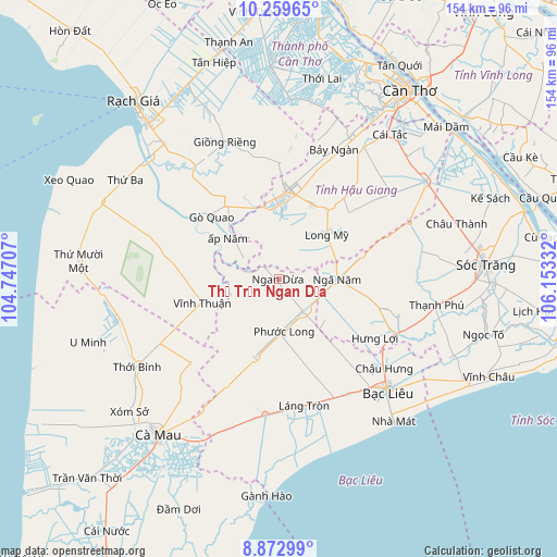
Thị Trấn Ngan Dừa GPS coordinates[2]
9° 34' 1.308" North, 105° 27' 0.684" East
| Map corner | latitude | longitude |
|---|---|---|
| Upper-left | 10.25965°, | 104.74707° |
| Center: | 9.56703°, | 105.45019° |
| Lower-right: | 8.87299°, | 106.15332° |
| Map W x H: | 154.2×154.2 km | = 95.8×95.8mi |
| max Lat: | 23.27841° ⇑96.9% North |
| Thị Trấn Ngan Dừa: | 9.56703° |
| min Lat: | ⇓3.1% South 8.65724° |
| min Long | Thị Trấn Ng | max Long |
| 102.4579° | 105.45019° | 112.72541° |
| W 21.5%⇐ | ⇒78.5% E |
Elevation
Elevation of Thị Trấn Ngan Dừa is 2 m = 7 ft, and this is 127.5 m = 418 ft below average elevation for this country.
| Max E: |
1592 m = 5223 ft | 98% |
| Avg. | 129.5 m = 425 ft | |
| Thị Trấn Ngan Dừa | 2 m = 7 ft | |
Min E: |
-1 m = -3 ft | 2% |
See also: Vietnam elevation on elevation.city.
Geographical zone
Thị Trấn Ngan Dừa is located in North Torrid zone (between Equator and Tropic of Cancer). Distance of Equator is 1063.8 km =661 mi to South.| Distance of | km | miles | from Thị Trấn Ngan Dừa |
|---|---|---|---|
| North Pole | 8943.3 | 5557.1 | to North |
| Arctic Circle | 6337.4 | 3937.9 | to North |
| Tropic Cancer | 1542.2 | 958.3 | to North |
| Equator | 1063.8 | 661 | to South |


Nearby cities:
15 places around Thị Trấn Ngan Dừa: (largest is in red/bold)
• Bạc Liêu
43 km =26.7 mi,  134°
134°
• Giồng Riềng
40.9 km =25.4 mi,  338°
338°
• Gò Quao
26.7 km =16.6 mi,  313°
313°
• Huỳnh Hữu Nghĩa
40.3 km =25 mi,  79°
79°
• Long Mỹ
18.5 km =11.5 mi,  46°
46°
• Một Ngàn
44.3 km =27.5 mi,  26°
26°
• Nàng Mau
22.5 km =14 mi,  24°
24°
• Phú Lộc
35.4 km =22 mi,  115°
115°
• Phụng Hiệp
39.1 km =24.3 mi, 52°
• Thị Trấn Giá Rai
36.6 km =22.7 mi,  179°
179°
• Thị Trấn Hòa Bình
37 km =23 mi,  147°
147°
• Thị Trấn Phước Long
14.5 km =9 mi,  174°
174°
• Thới Bình
45.1 km =28 mi,  238°
238°
• Vĩnh Thuận
22.1 km =13.7 mi,  252°
252°
• Vị Thanh
24.3 km =15.1 mi,  5°
5°
Sources, notices
• [Note1] Compared only with cities in Vietnam existing in our database
• [Src1] Map data: © OpenStreetMap contributors (CC-BY-SA)
• [Src2] Other city data from geonames.org with taken over terms of usage.
• [Src3] Geographical zone / Annual Mean Temperature by Robert A. Rohde @ Wikipedia
