Cổ Phúc geodata
Cổ Phúc (Yên Bái) is a seat of a second-order administrative division; located in Vietnam in Asia/Ho_Chi_Minh (GMT+7) time zone. In our database, there are 94 cities with bigger population. Compared to other cities in Vietnam, 88.4% of cities are located further ↓South; 92% of cities are located further →East and 66.6% of cities have lower elevation than Cổ Phúc. Note1


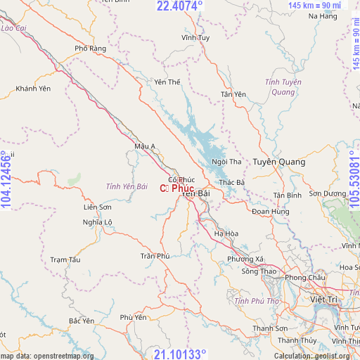
Cổ Phúc GPS coordinates[2]
21° 45' 21.06" North, 104° 49' 39.648" East
| Map corner | latitude | longitude |
|---|---|---|
| Upper-left | 22.4074°, | 104.12456° |
| Center: | 21.75585°, | 104.82768° |
| Lower-right: | 21.10133°, | 105.53081° |
| Map W x H: | 145.2×145.2 km | = 90.2×90.2mi |
| max Lat: | 23.27841° ⇑11.6% North |
| Cổ Phúc: | 21.75585° |
| min Lat: | ⇓88.4% South 8.65724° |
| min Long | Cổ Phúc | max Long |
| 102.4579° | 104.82768° | 112.72541° |
| W 8%⇐ | ⇒92% E |
Elevation
Elevation of Cổ Phúc is 41 m = 135 ft, and this is 88.5 m = 290 ft below average elevation for this country.
| Max E: |
1592 m = 5223 ft | 33.4% |
| Avg. | 129.5 m = 425 ft | |
| Cổ Phúc | 41 m = 135 ft | |
Min E: |
-1 m = -3 ft | 66.6% |
See also: Vietnam elevation on elevation.city.
Geographical zone
Cổ Phúc is located in North Torrid zone (between Equator and Tropic of Cancer). Distance of this Northern Tropic circle is 186.9 km =116.1 mi to North.| Distance of | km | miles | from Cổ Phúc |
|---|---|---|---|
| North Pole | 7588 | 4715 | to North |
| Arctic Circle | 4982.2 | 3095.8 | to North |
| Tropic Cancer | 186.9 | 116.1 | to North |
| Equator | 2419 | 1503.1 | to South |


Nearby cities:
15 places around Cổ Phúc: (largest is in red/bold)
• Hạ Hòa
28.2 km =17.5 mi,  139°
139°
• Phù Yên
58 km =36 mi,  199°
199°
• Phú Thọ
56.9 km =35.4 mi,  134°
134°
• Sông Thao
48.8 km =30.3 mi, 139°
• Sơn Dương
59.4 km =36.9 mi,  96°
96°
• Sơn Thịnh
32.3 km =20.1 mi,  228°
228°
• Thanh Ba
43.2 km =26.8 mi, 131°
• Thị Trấn Trạm Tấu
56.4 km =35 mi,  235°
235°
• Thị Trấn Tân Yên
40.5 km =25.2 mi,  31°
31°
• Thị Trấn Vĩnh Tuy
58 km =36 mi,  6°
6°
• Thị Trấn Yên Thế
39.9 km =24.8 mi,  351°
351°
• Tuyên Quang
40.6 km =25.2 mi,  79°
79°
• Yên Bái
9.4 km =5.8 mi,  112°
112°
• Yên Lập
51.3 km =31.9 mi,  152°
152°
• Đoan Hùng
39.7 km =24.7 mi, 111°
Sources, notices
• [Note1] Compared only with cities in Vietnam existing in our database
• [Src1] Map data: © OpenStreetMap contributors (CC-BY-SA)
• [Src2] Other city data from geonames.org with taken over terms of usage.
• [Src3] Geographical zone / Annual Mean Temperature by Robert A. Rohde @ Wikipedia
