Sơn Thịnh geodata
Sơn Thịnh (Yên Bái) is a seat of a second-order administrative division; located in Vietnam in Asia/Ho_Chi_Minh (GMT+7) time zone. In our database, there are 94 cities with bigger population. Compared to other cities in Vietnam, 86.8% of cities are located further ↓South; 93.5% of cities are located further →East and 85.5% of cities have lower elevation than Sơn Thịnh. Note1


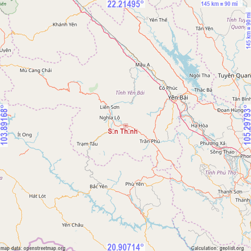
Sơn Thịnh GPS coordinates[2]
21° 33' 45.072" North, 104° 35' 41.28" East
| Map corner | latitude | longitude |
|---|---|---|
| Upper-left | 22.21495°, | 103.89168° |
| Center: | 21.56252°, | 104.5948° |
| Lower-right: | 20.90714°, | 105.29793° |
| Map W x H: | 145.4×145.4 km | = 90.3×90.3mi |
| max Lat: | 23.27841° ⇑13.2% North |
| Sơn Thịnh: | 21.56252° |
| min Lat: | ⇓86.8% South 8.65724° |
| min Long | Sơn Thịnh | max Long |
| 102.4579° | 104.5948° | 112.72541° |
| W 6.5%⇐ | ⇒93.5% E |
Elevation
Elevation of Sơn Thịnh is 316 m = 1037 ft, and this is 186.5 m = 612 ft above average elevation for this country.
| Max E: |
1592 m = 5223 ft | 14.5% |
| Sơn Thịnh | 316 m 1037 ft | |
| Avg. | 129.5 m = 425 ft | |
Min E: |
-1 m = -3 ft | 85.5% |
See also: Vietnam elevation on elevation.city.
Geographical zone
Sơn Thịnh is located in North Torrid zone (between Equator and Tropic of Cancer). Distance of this Northern Tropic circle is 208.4 km =129.5 mi to North.| Distance of | km | miles | from Sơn Thịnh |
|---|---|---|---|
| North Pole | 7609.5 | 4728.3 | to North |
| Arctic Circle | 5003.6 | 3109.1 | to North |
| Tropic Cancer | 208.4 | 129.5 | to North |
| Equator | 2397.5 | 1489.7 | to South |


Nearby cities:
15 places around Sơn Thịnh: (largest is in red/bold)
• Bắc Yên
39 km =24.2 mi,  205°
205°
• Cổ Phúc
32.3 km =20.1 mi,  48°
48°
• Hát Lót
64.9 km =40.3 mi,  231°
231°
• Hạ Hòa
42.4 km =26.3 mi,  89°
89°
• Mù Cang Chải
61.3 km =38.1 mi,  301°
301°
• Phù Yên
33.7 km =20.9 mi,  171°
171°
• Sông Thao
57.9 km =36 mi,  105°
105°
• Thanh Ba
56.9 km =35.4 mi,  97°
97°
• Thị Trấn Trạm Tấu
24.7 km =15.3 mi,  244°
244°
• Thị Trấn Yên Thế
63.5 km =39.5 mi,  16°
16°
• Yên Bái
37.3 km =23.2 mi,  61°
61°
• Yên Châu
65 km =40.4 mi, 207°
• Yên Lập
53.5 km =33.2 mi,  116°
116°
• Ít Ong
58.9 km =36.6 mi,  265°
265°
• Đoan Hùng
61.3 km =38.1 mi,  83°
83°
Sources, notices
• [Note1] Compared only with cities in Vietnam existing in our database
• [Src1] Map data: © OpenStreetMap contributors (CC-BY-SA)
• [Src2] Other city data from geonames.org with taken over terms of usage.
• [Src3] Geographical zone / Annual Mean Temperature by Robert A. Rohde @ Wikipedia
