Lương Bằng geodata
Lương Bằng (Hưng Yên) is a seat of a second-order administrative division; located in Vietnam in Asia/Ho_Chi_Minh (GMT+7) time zone. In our database, there are 94 cities with bigger population. Compared to other cities in Vietnam, 68.4% of cities are located further ↓South; 52.2% of cities are located further →East and 75% of cities have higher elevation than Lương Bằng. Note1


Lương Bằng GPS coordinates[2]
20° 44' 24.108" North, 106° 3' 35.928" East
| Map corner | latitude | longitude |
|---|---|---|
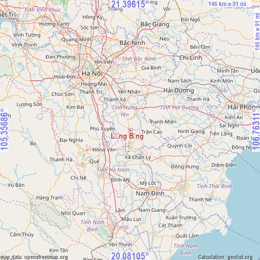
| Upper-left | 21.39615°, | 105.35686° |
| Center: | 20.74003°, | 106.05998° |
| Lower-right: | 20.08105°, | 106.76311° |
| Map W x H: | 146.2×146.2 km | = 90.8×90.8mi |
| max Lat: | 23.27841° ⇑31.6% North |
| Lương Bằng: | 20.74003° |
| min Lat: | ⇓68.4% South 8.65724° |
| min Long | Lương Bằng | max Long |
| 102.4579° | 106.05998° | 112.72541° |
| W 47.8%⇐ | ⇒52.2% E |
Elevation
Elevation of Lương Bằng is 7 m = 23 ft, and this is 122.5 m = 402 ft below average elevation for this country.
| Max E: |
1592 m = 5223 ft | 75% |
| Avg. | 129.5 m = 425 ft | |
| Lương Bằng | 7 m = 23 ft | |
Min E: |
-1 m = -3 ft | 25% |
See also: Vietnam elevation on elevation.city.
Geographical zone
Lương Bằng is located in North Torrid zone (between Equator and Tropic of Cancer). Distance of this Northern Tropic circle is 299.8 km =186.3 mi to North.| Distance of | km | miles | from Lương Bằng |
|---|---|---|---|
| North Pole | 7701 | 4785.2 | to North |
| Arctic Circle | 5095.1 | 3165.9 | to North |
| Tropic Cancer | 299.8 | 186.3 | to North |
| Equator | 2306.1 | 1432.9 | to South |


Nearby cities:
15 places around Lương Bằng: (largest is in red/bold)
• Bẩn Yên Nhân
21.9 km =13.6 mi,  359°
359°
• Hòa Mạc
13.2 km =8.2 mi,  214°
214°
• Hưng Hà
23.9 km =14.9 mi,  134°
134°
• Hưng Yên
10.5 km =6.5 mi,  185°
185°
• Khoái Châu
14 km =8.7 mi,  322°
322°
• Kẻ Sặt
21 km =13 mi,  25°
25°
• Phú Xuyên
15.2 km =9.4 mi,  272°
272°
• Thanh Miện
20.1 km =12.5 mi,  74°
74°
• Thường Tín
25.1 km =15.6 mi,  304°
304°
• Trần Cao
12.5 km =7.8 mi,  95°
95°
• Văn Giang
26.2 km =16.3 mi,  329°
329°
• Vĩnh Trụ
20.3 km =12.6 mi, 189°
• Vương
7.4 km =4.6 mi, 125°
• Yên Mỹ
16.4 km =10.2 mi,  351°
351°
• Ân Thi
9.3 km =5.8 mi,  20°
20°
Sources, notices
• [Note1] Compared only with cities in Vietnam existing in our database
• [Src1] Map data: © OpenStreetMap contributors (CC-BY-SA)
• [Src2] Other city data from geonames.org with taken over terms of usage.
• [Src3] Geographical zone / Annual Mean Temperature by Robert A. Rohde @ Wikipedia
