Thuận Nam geodata
Thuận Nam (Bình Thuận) is a seat of a second-order administrative division; located in Vietnam in Asia/Ho_Chi_Minh (GMT+7) time zone. In our database, there are 94 cities with bigger population. Compared to other cities in Vietnam, 77% of cities are located further ↑North; 83.4% of cities are located further ←West and 64.6% of cities have lower elevation than Thuận Nam. Note1


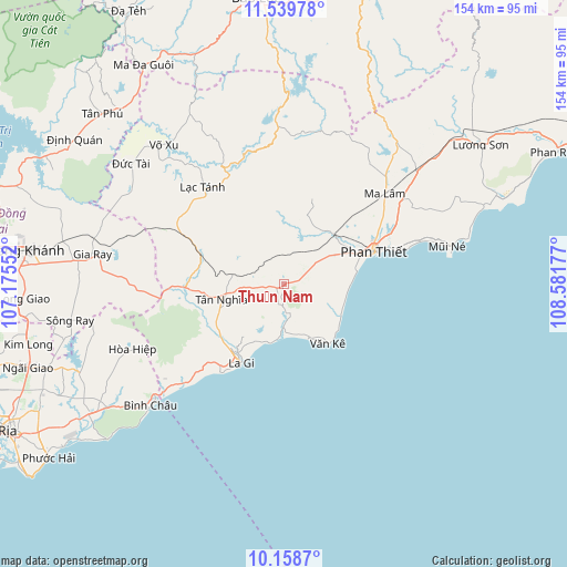
Thuận Nam GPS coordinates[2]
10° 51' 0.144" North, 107° 52' 43.104" East
| Map corner | latitude | longitude |
|---|---|---|
| Upper-left | 11.53978°, | 107.17552° |
| Center: | 10.85004°, | 107.87864° |
| Lower-right: | 10.1587°, | 108.58177° |
| Map W x H: | 153.6×153.6 km | = 95.4×95.4mi |
| max Lat: | 23.27841° ⇑77% North |
| Thuận Nam: | 10.85004° |
| min Lat: | ⇓23% South 8.65724° |
| min Long | Thuận Nam | max Long |
| 102.4579° | 107.87864° | 112.72541° |
| W 83.4%⇐ | ⇒16.6% E |
Elevation
Elevation of Thuận Nam is 33 m = 108 ft, and this is 96.5 m = 317 ft below average elevation for this country.
| Max E: |
1592 m = 5223 ft | 35.4% |
| Avg. | 129.5 m = 425 ft | |
| Thuận Nam | 33 m = 108 ft | |
Min E: |
-1 m = -3 ft | 64.6% |
See also: Vietnam elevation on elevation.city.
Geographical zone
Thuận Nam is located in North Torrid zone (between Equator and Tropic of Cancer). Distance of Equator is 1206.4 km =749.6 mi to South.| Distance of | km | miles | from Thuận Nam |
|---|---|---|---|
| North Pole | 8800.7 | 5468.5 | to North |
| Arctic Circle | 6194.8 | 3849.3 | to North |
| Tropic Cancer | 1399.5 | 869.6 | to North |
| Equator | 1206.4 | 749.6 | to South |


Nearby cities:
15 places around Thuận Nam: (largest is in red/bold)
• Bảo Lộc
78 km =48.5 mi,  354°
354°
• Chợ Lầu
80.1 km =49.8 mi,  58°
58°
• Gia Ray
52.8 km =32.8 mi,  279°
279°
• La Gi
24.1 km =15 mi,  208°
208°
• Long Khánh
69.4 km =43.1 mi, 277°
• Ma Lâm
37 km =23 mi,  47°
47°
• Ma Đa Gui
70.5 km =43.8 mi,  327°
327°
• Phan Thiết
25.9 km =16.1 mi,  70°
70°
• Phuoc Tho
77.6 km =48.2 mi,  239°
239°
• Thị Trấn Ngải Giao
72.7 km =45.2 mi,  251°
251°
• Thị Trấn Phước Bửu
62.8 km =39 mi, 236°
• Thống Nhất
80.8 km =50.2 mi, 277°
• Tánh Linh
33.8 km =21 mi,  320°
320°
• Tân Phú
67.3 km =41.8 mi,  314°
314°
• Võ Xu
51.1 km =31.8 mi, 317°
Sources, notices
• [Note1] Compared only with cities in Vietnam existing in our database
• [Src1] Map data: © OpenStreetMap contributors (CC-BY-SA)
• [Src2] Other city data from geonames.org with taken over terms of usage.
• [Src3] Geographical zone / Annual Mean Temperature by Robert A. Rohde @ Wikipedia
