Tân Hòa geodata
Tân Hòa (Tiền Giang) is a seat of a second-order administrative division; located in Vietnam in Asia/Ho_Chi_Minh (GMT+7) time zone. In our database, there are 94 cities with bigger population. Compared to other cities in Vietnam, 86.9% of cities are located further ↑North; 70% of cities are located further ←West and 92.5% of cities have higher elevation than Tân Hòa. Note1


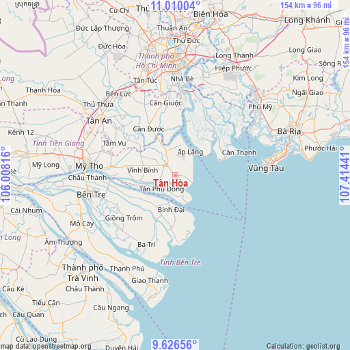
Tân Hòa GPS coordinates[2]
10° 19' 8.616" North, 106° 42' 40.608" East
| Map corner | latitude | longitude |
|---|---|---|
| Upper-left | 11.01004°, | 106.00816° |
| Center: | 10.31906°, | 106.71128° |
| Lower-right: | 9.62656°, | 107.41441° |
| Map W x H: | 153.8×153.8 km | = 95.6×95.6mi |
| max Lat: | 23.27841° ⇑86.9% North |
| Tân Hòa: | 10.31906° |
| min Lat: | ⇓13.1% South 8.65724° |
| min Long | Tân Hòa | max Long |
| 102.4579° | 106.71128° | 112.72541° |
| W 70%⇐ | ⇒30% E |
Elevation
Elevation of Tân Hòa is 4 m = 13 ft, and this is 125.5 m = 412 ft below average elevation for this country.
| Max E: |
1592 m = 5223 ft | 92.5% |
| Avg. | 129.5 m = 425 ft | |
| Tân Hòa | 4 m = 13 ft | |
Min E: |
-1 m = -3 ft | 7.5% |
See also: Vietnam elevation on elevation.city.
Geographical zone
Tân Hòa is located in North Torrid zone (between Equator and Tropic of Cancer). Distance of Equator is 1147.4 km =713 mi to South.| Distance of | km | miles | from Tân Hòa |
|---|---|---|---|
| North Pole | 8859.7 | 5505.2 | to North |
| Arctic Circle | 6253.8 | 3885.9 | to North |
| Tropic Cancer | 1458.5 | 906.3 | to North |
| Equator | 1147.4 | 713 | to South |


Nearby cities:
15 places around Tân Hòa: (largest is in red/bold)
• Ba Tri
33.3 km =20.7 mi,  203°
203°
• Bình Đại
14.6 km =9.1 mi,  188°
188°
• Bến Tre
37.7 km =23.4 mi,  256°
256°
• Châu Thành
38.8 km =24.1 mi,  267°
267°
• Chợ Gạo
27.3 km =17 mi,  277°
277°
• Cần Giuộc
32.5 km =20.2 mi,  352°
352°
• Cần Giờ
28.5 km =17.7 mi,  68°
68°
• Cần Đước
24.3 km =15.1 mi,  330°
330°
• Giồng Trôm
29.3 km =18.2 mi,  230°
230°
• Mỹ Tho
38.7 km =24 mi, 276°
• Tân An
40.5 km =25.2 mi,  306°
306°
• Tân Trụ
31 km =19.3 mi, 314°
• Tầm Vu
29.9 km =18.6 mi,  297°
297°
• Vĩnh Bình
14.6 km =9.1 mi, 281°
• Vũng Tàu
40.9 km =25.4 mi,  85°
85°
Sources, notices
• [Note1] Compared only with cities in Vietnam existing in our database
• [Src1] Map data: © OpenStreetMap contributors (CC-BY-SA)
• [Src2] Other city data from geonames.org with taken over terms of usage.
• [Src3] Geographical zone / Annual Mean Temperature by Robert A. Rohde @ Wikipedia
