Vũng Tàu geodata
Vũng Tàu (Bà Rịa-Vũng Tàu) is a populated place; located in Vietnam in Asia/Ho_Chi_Minh (GMT+7) time zone. With population of 209,683 people, there are 11 cities with bigger population in this country. Compared to other cities in Vietnam, 86.6% of cities are located further ↑North; 75.2% of cities are located further ←West and 61.7% of cities have higher elevation than Vũng Tàu. Note1


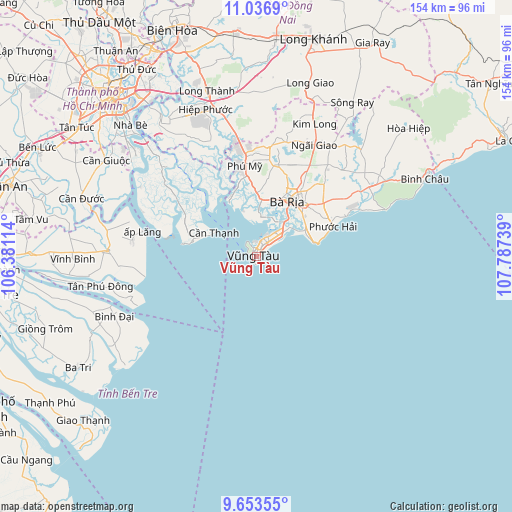
Vũng Tàu GPS coordinates[2]
10° 20' 45.564" North, 107° 5' 3.336" East
| Map corner | latitude | longitude |
|---|---|---|
| Upper-left | 11.0369°, | 106.38114° |
| Center: | 10.34599°, | 107.08426° |
| Lower-right: | 9.65355°, | 107.78739° |
| Map W x H: | 153.8×153.8 km | = 95.6×95.6mi |
| max Lat: | 23.27841° ⇑86.6% North |
| Vũng Tàu: | 10.34599° |
| min Lat: | ⇓13.4% South 8.65724° |
| min Long | Vũng Tàu | max Long |
| 102.4579° | 107.08426° | 112.72541° |
| W 75.2%⇐ | ⇒24.8% E |
Elevation
Elevation of Vũng Tàu is 10 m = 33 ft, and this is 119.5 m = 392 ft below average elevation for this country.
| Max E: |
1592 m = 5223 ft | 61.7% |
| Avg. | 129.5 m = 425 ft | |
| Vũng Tàu | 10 m = 33 ft | |
Min E: |
-1 m = -3 ft | 38.3% |
See also: Vũng Tàu elevation on elevation.city.
Geographical zone
Vũng Tàu is located in North Torrid zone (between Equator and Tropic of Cancer). Distance of Equator is 1150.4 km =714.8 mi to South.| Distance of | km | miles | from Vũng Tàu |
|---|---|---|---|
| North Pole | 8856.7 | 5503.3 | to North |
| Arctic Circle | 6250.8 | 3884.1 | to North |
| Tropic Cancer | 1455.6 | 904.5 | to North |
| Equator | 1150.4 | 714.8 | to South |


Nearby cities:
15 places around Vũng Tàu: (largest is in red/bold)
• Bình Đại
46.4 km =28.8 mi,  247°
247°
• Cần Giuộc
53.8 km =33.4 mi,  302°
302°
• Cần Giờ
15.9 km =9.9 mi, 297°
• Long Thành
51.4 km =31.9 mi,  343°
343°
• Nhà Bè
54.2 km =33.7 mi,  316°
316°
• Nhơn Trạch
47.3 km =29.4 mi,  332°
332°
• Phuoc Tho
25.9 km =16.1 mi,  51°
51°
• Thành Phố Bà Rịa
19.1 km =11.9 mi,  28°
28°
• Thị Trấn Long Điền
20.9 km =13 mi,  42°
42°
• Thị Trấn Ngải Giao
37.9 km =23.5 mi, 27°
• Thị Trấn Phú Mỹ
28.8 km =17.9 mi,  353°
353°
• Thị Trấn Phước Bửu
40.6 km =25.2 mi,  58°
58°
• Thị Xã Phú Mỹ
25.2 km =15.7 mi,  11°
11°
• Tân Hòa
40.9 km =25.4 mi,  265°
265°
• Vĩnh Bình
55.1 km =34.2 mi, 269°
In other languages:
- In Spanish: Vung Tau
- In France: Cap-Saint-Jacques, Ville du Cap, Vũng Tàu
- In German: Vung Tau
- In Italian: Vung Tau
- In Russian: Вунгтау
Sources, notices
• [Note1] Compared only with cities in Vietnam existing in our database
• [Src1] Map data: © OpenStreetMap contributors (CC-BY-SA)
• [Src2] Other city data from geonames.org with taken over terms of usage.
• [Src3] Geographical zone / Annual Mean Temperature by Robert A. Rohde @ Wikipedia
