Trần Văn Thời geodata
Trần Văn Thời (Cà Mau) is a seat of a second-order administrative division; located in Vietnam in Asia/Ho_Chi_Minh (GMT+7) time zone. In our database, there are 94 cities with bigger population. Compared to other cities in Vietnam, 98.9% of cities are located further ↑North; 90.4% of cities are located further →East and 99.2% of cities have higher elevation than Trần Văn Thời. Note1


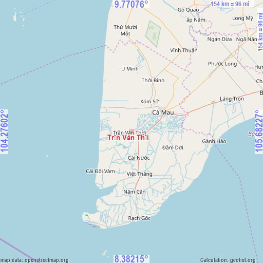
Trần Văn Thời GPS coordinates[2]
9° 4' 37.668" North, 104° 58' 44.904" East
| Map corner | latitude | longitude |
|---|---|---|
| Upper-left | 9.77076°, | 104.27602° |
| Center: | 9.07713°, | 104.97914° |
| Lower-right: | 8.38215°, | 105.68227° |
| Map W x H: | 154.4×154.4 km | = 95.9×95.9mi |
| max Lat: | 23.27841° ⇑98.9% North |
| Trần Văn Thời: | 9.07713° |
| min Lat: | ⇓1.1% South 8.65724° |
| min Long | Trần Văn Th� | max Long |
| 102.4579° | 104.97914° | 112.72541° |
| W 9.6%⇐ | ⇒90.4% E |
Elevation
Elevation of Trần Văn Thời is 1 m = 3 ft, and this is 128.5 m = 422 ft below average elevation for this country.
| Max E: |
1592 m = 5223 ft | 99.2% |
| Avg. | 129.5 m = 425 ft | |
| Trần Văn Thời | 1 m = 3 ft | |
Min E: |
-1 m = -3 ft | 0.8% |
See also: Vietnam elevation on elevation.city.
Geographical zone
Trần Văn Thời is located in North Torrid zone (between Equator and Tropic of Cancer). Distance of Equator is 1009.3 km =627.1 mi to South.| Distance of | km | miles | from Trần Văn Thời |
|---|---|---|---|
| North Pole | 8997.8 | 5591 | to North |
| Arctic Circle | 6391.9 | 3971.7 | to North |
| Tropic Cancer | 1596.6 | 992.1 | to North |
| Equator | 1009.3 | 627.1 | to South |


Nearby cities:
15 places around Trần Văn Thời: (largest is in red/bold)
• Cai Doi Vam
30.6 km =19 mi,  216°
216°
• Cà Mau
22 km =13.7 mi,  59°
59°
• Cái Nước
15.5 km =9.6 mi,  165°
165°
• Ngọc Hiển
47.5 km =29.5 mi, 169°
• Năm Căn
35.4 km =22 mi,  177°
177°
• Thị Trấn Giá Rai
55.2 km =34.3 mi,  71°
71°
• Thị Trấn Gành Hào
48.8 km =30.3 mi,  95°
95°
• Thị Trấn Hòa Bình
75 km =46.6 mi, 72°
• Thị Trấn Ngan Dừa
75.1 km =46.7 mi,  43°
43°
• Thị Trấn Phước Long
66.5 km =41.3 mi,  52°
52°
• Thới Bình
33.7 km =20.9 mi,  23°
23°
• Thứ Mười Một
59.5 km =37 mi,  356°
356°
• U Minh
37.3 km =23.2 mi, 359°
• Vĩnh Thuận
56.8 km =35.3 mi,  32°
32°
• Đầm Dơi
25.6 km =15.9 mi,  111°
111°
Sources, notices
• [Note1] Compared only with cities in Vietnam existing in our database
• [Src1] Map data: © OpenStreetMap contributors (CC-BY-SA)
• [Src2] Other city data from geonames.org with taken over terms of usage.
• [Src3] Geographical zone / Annual Mean Temperature by Robert A. Rohde @ Wikipedia
