Thị Trấn Mường Khương geodata
Thị Trấn Mường Khương (Lào Cai) is a seat of a second-order administrative division; located in Vietnam in Asia/Ho_Chi_Minh (GMT+7) time zone. In our database, there are 94 cities with bigger population. Compared to other cities in Vietnam, 97.9% of cities are located further ↓South; 95.6% of cities are located further →East and 96.1% of cities have lower elevation than Thị Trấn Mường Khương. Note1


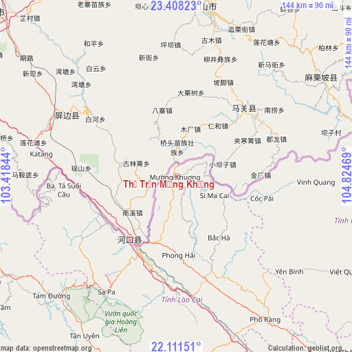
Thị Trấn Mường Khương GPS coordinates[2]
22° 45' 41.076" North, 104° 7' 17.616" East
| Map corner | latitude | longitude |
|---|---|---|
| Upper-left | 23.40823°, | 103.41844° |
| Center: | 22.76141°, | 104.12156° |
| Lower-right: | 22.11151°, | 104.82469° |
| Map W x H: | 144.2×144.2 km | = 89.6×89.6mi |
| max Lat: | 23.27841° ⇑2.1% North |
| Thị Trấn Mường Khương: | 22.76141° |
| min Lat: | ⇓97.9% South 8.65724° |
| min Long | Thị Trấn M� | max Long |
| 102.4579° | 104.12156° | 112.72541° |
| W 4.4%⇐ | ⇒95.6% E |
Elevation
Elevation of Thị Trấn Mường Khương is 771 m = 2530 ft, and this is 641.5 m = 2105 ft above average elevation for this country.
| Max E: |
1592 m = 5223 ft | 3.9% |
| Thị Trấn Mường Khương | 771 m 2530 ft | |
| Avg. | 129.5 m = 425 ft | |
Min E: |
-1 m = -3 ft | 96.1% |
See also: Vietnam elevation on elevation.city.
Geographical zone
Thị Trấn Mường Khương is located in North Torrid zone (between Equator and Tropic of Cancer). Distance of this Northern Tropic circle is 75.1 km =46.7 mi to North.| Distance of | km | miles | from Thị Trấn Mường Khương |
|---|---|---|---|
| North Pole | 7476.2 | 4645.5 | to North |
| Arctic Circle | 4870.3 | 3026.3 | to North |
| Tropic Cancer | 75.1 | 46.7 | to North |
| Equator | 2530.8 | 1572.6 | to South |


Nearby cities:
15 places around Thị Trấn Mường Khương: (largest is in red/bold)
• Bát Xát
34 km =21.1 mi,  224°
224°
• Bắc Hà
30.3 km =18.8 mi,  144°
144°
• Cát Cát
56.8 km =35.3 mi,  212°
212°
• Lai Châu
79.3 km =49.3 mi,  239°
239°
• Lao Chải
56.2 km =34.9 mi, 207°
• Lào Cai
34.4 km =21.4 mi, 206°
• Sa Pa
54.8 km =34.1 mi, 211°
• Si Ma Cai
17.7 km =11 mi,  114°
114°
• Tam Đường
70.8 km =44 mi,  225°
225°
• Thị Trấn Khánh Yên
75.9 km =47.2 mi,  169°
169°
• Thị Trấn Phố Lu
49.6 km =30.8 mi, 172°
• Thị Trấn Phố Ràng
69 km =42.9 mi,  148°
148°
• Thị Trấn Vinh Quang
57.3 km =35.6 mi,  92°
92°
• Thị Trấn Việt Quang
80.2 km =49.8 mi,  118°
118°
• Yên Bình
61.1 km =38 mi,  129°
129°
Sources, notices
• [Note1] Compared only with cities in Vietnam existing in our database
• [Src1] Map data: © OpenStreetMap contributors (CC-BY-SA)
• [Src2] Other city data from geonames.org with taken over terms of usage.
• [Src3] Geographical zone / Annual Mean Temperature by Robert A. Rohde @ Wikipedia
