Thị Trấn Phố Lu geodata
Thị Trấn Phố Lu (Lào Cai) is a seat of a second-order administrative division; located in Vietnam in Asia/Ho_Chi_Minh (GMT+7) time zone. In our database, there are 94 cities with bigger population. Compared to other cities in Vietnam, 93.5% of cities are located further ↓South; 95.3% of cities are located further →East and 73.2% of cities have lower elevation than Thị Trấn Phố Lu. Note1


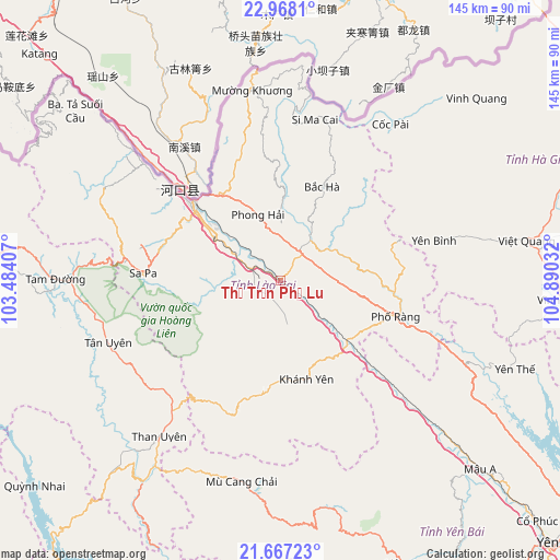
Thị Trấn Phố Lu GPS coordinates[2]
22° 19' 9.048" North, 104° 11' 13.884" East
| Map corner | latitude | longitude |
|---|---|---|
| Upper-left | 22.9681°, | 103.48407° |
| Center: | 22.31918°, | 104.18719° |
| Lower-right: | 21.66723°, | 104.89032° |
| Map W x H: | 144.6×144.6 km | = 89.9×89.9mi |
| max Lat: | 23.27841° ⇑6.5% North |
| Thị Trấn Phố Lu: | 22.31918° |
| min Lat: | ⇓93.5% South 8.65724° |
| min Long | Thị Trấn Ph | max Long |
| 102.4579° | 104.18719° | 112.72541° |
| W 4.7%⇐ | ⇒95.3% E |
Elevation
Elevation of Thị Trấn Phố Lu is 77 m = 253 ft, and this is 52.5 m = 172 ft below average elevation for this country.
| Max E: |
1592 m = 5223 ft | 26.8% |
| Avg. | 129.5 m = 425 ft | |
| Thị Trấn Phố Lu | 77 m = 253 ft | |
Min E: |
-1 m = -3 ft | 73.2% |
See also: Vietnam elevation on elevation.city.
Geographical zone
Thị Trấn Phố Lu is located in North Torrid zone (between Equator and Tropic of Cancer). Distance of this Northern Tropic circle is 124.3 km =77.2 mi to North.| Distance of | km | miles | from Thị Trấn Phố Lu |
|---|---|---|---|
| North Pole | 7525.4 | 4676.1 | to North |
| Arctic Circle | 4919.5 | 3056.8 | to North |
| Tropic Cancer | 124.3 | 77.2 | to North |
| Equator | 2481.7 | 1542.1 | to South |


Nearby cities:
15 places around Thị Trấn Phố Lu: (largest is in red/bold)
• Bát Xát
39.4 km =24.5 mi,  309°
309°
• Bắc Hà
26.8 km =16.7 mi,  23°
23°
• Cát Cát
37.3 km =23.2 mi,  271°
271°
• Lao Chải
32.8 km =20.4 mi, 268°
• Lào Cai
28.9 km =18 mi, 309°
• Mù Cang Chải
53 km =32.9 mi,  190°
190°
• Sa Pa
35.4 km =22 mi, 273°
• Si Ma Cai
42.8 km =26.6 mi,  12°
12°
• Tam Đường
57.7 km =35.9 mi, 269°
• Than Uyên
51 km =31.7 mi,  218°
218°
• Thị Trấn Khánh Yên
26.4 km =16.4 mi,  165°
165°
• Thị Trấn Mường Khương
49.6 km =30.8 mi,  352°
352°
• Thị Trấn Phố Ràng
31.2 km =19.4 mi,  107°
107°
• Thị Trấn Yên Thế
64.1 km =39.8 mi, 111°
• Yên Bình
41.6 km =25.8 mi,  75°
75°
Sources, notices
• [Note1] Compared only with cities in Vietnam existing in our database
• [Src1] Map data: © OpenStreetMap contributors (CC-BY-SA)
• [Src2] Other city data from geonames.org with taken over terms of usage.
• [Src3] Geographical zone / Annual Mean Temperature by Robert A. Rohde @ Wikipedia
