Yên Bình geodata
Yên Bình (Hà Giang) is a seat of a second-order administrative division; located in Vietnam in Asia/Ho_Chi_Minh (GMT+7) time zone. In our database, there are 94 cities with bigger population. Compared to other cities in Vietnam, 94.6% of cities are located further ↓South; 93.6% of cities are located further →East and 75.9% of cities have lower elevation than Yên Bình. Note1


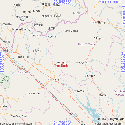
Yên Bình GPS coordinates[2]
22° 24' 35.604" North, 104° 34' 46.164" East
| Map corner | latitude | longitude |
|---|---|---|
| Upper-left | 23.05838°, | 103.87637° |
| Center: | 22.40989°, | 104.57949° |
| Lower-right: | 21.75836°, | 105.28262° |
| Map W x H: | 144.5×144.6 km | = 89.8×89.9mi |
| max Lat: | 23.27841° ⇑5.4% North |
| Yên Bình: | 22.40989° |
| min Lat: | ⇓94.6% South 8.65724° |
| min Long | Yên Bình | max Long |
| 102.4579° | 104.57949° | 112.72541° |
| W 6.4%⇐ | ⇒93.6% E |
Elevation
Elevation of Yên Bình is 112 m = 367 ft, and this is 17.5 m = 57 ft below average elevation for this country.
| Max E: |
1592 m = 5223 ft | 24.1% |
| Avg. | 129.5 m = 425 ft | |
| Yên Bình | 112 m = 367 ft | |
Min E: |
-1 m = -3 ft | 75.9% |
See also: Vietnam elevation on elevation.city.
Geographical zone
Yên Bình is located in North Torrid zone (between Equator and Tropic of Cancer). Distance of this Northern Tropic circle is 114.2 km =71 mi to North.| Distance of | km | miles | from Yên Bình |
|---|---|---|---|
| North Pole | 7515.3 | 4669.8 | to North |
| Arctic Circle | 4909.4 | 3050.6 | to North |
| Tropic Cancer | 114.2 | 71 | to North |
| Equator | 2491.7 | 1548.3 | to South |


Nearby cities:
15 places around Yên Bình: (largest is in red/bold)
• Bắc Hà
32.8 km =20.4 mi,  296°
296°
• Hà Giang
61.9 km =38.5 mi,  42°
42°
• Lào Cai
63.1 km =39.2 mi,  277°
277°
• Si Ma Cai
44.3 km =27.5 mi,  315°
315°
• Thị Trấn Khánh Yên
49.1 km =30.5 mi,  223°
223°
• Thị Trấn Mường Khương
61.1 km =38 mi,  309°
309°
• Thị Trấn Phố Lu
41.6 km =25.8 mi,  255°
255°
• Thị Trấn Phố Ràng
22.2 km =13.8 mi,  208°
208°
• Thị Trấn Tân Yên
60.5 km =37.6 mi,  129°
129°
• Thị Trấn Vinh Quang
38.2 km =23.7 mi,  15°
15°
• Thị Trấn Việt Lâm
45.8 km =28.5 mi,  58°
58°
• Thị Trấn Việt Quang
23.4 km =14.5 mi,  88°
88°
• Thị Trấn Vĩnh Tuy
35.4 km =22 mi,  115°
115°
• Thị Trấn Vị Xuyên
50.3 km =31.3 mi, 55°
• Thị Trấn Yên Thế
38.5 km =23.9 mi,  149°
149°
Sources, notices
• [Note1] Compared only with cities in Vietnam existing in our database
• [Src1] Map data: © OpenStreetMap contributors (CC-BY-SA)
• [Src2] Other city data from geonames.org with taken over terms of usage.
• [Src3] Geographical zone / Annual Mean Temperature by Robert A. Rohde @ Wikipedia
