Bát Xát geodata
Bát Xát (Lào Cai) is a seat of a second-order administrative division; located in Vietnam in Asia/Ho_Chi_Minh (GMT+7) time zone. In our database, there are 94 cities with bigger population. Compared to other cities in Vietnam, 95.8% of cities are located further ↓South; 96.7% of cities are located further →East and 75.4% of cities have lower elevation than Bát Xát. Note1


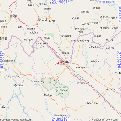
Bát Xát GPS coordinates[2]
22° 32' 35.196" North, 103° 53' 23.604" East
| Map corner | latitude | longitude |
|---|---|---|
| Upper-left | 23.19097°, | 103.18677° |
| Center: | 22.54311°, | 103.88989° |
| Lower-right: | 21.89219°, | 104.59302° |
| Map W x H: | 144.4×144.4 km | = 89.7×89.7mi |
| max Lat: | 23.27841° ⇑4.2% North |
| Bát Xát: | 22.54311° |
| min Lat: | ⇓95.8% South 8.65724° |
| min Long | Bát Xát | max Long |
| 102.4579° | 103.88989° | 112.72541° |
| W 3.3%⇐ | ⇒96.7% E |
Elevation
Elevation of Bát Xát is 109 m = 358 ft, and this is 20.5 m = 67 ft below average elevation for this country.
| Max E: |
1592 m = 5223 ft | 24.6% |
| Avg. | 129.5 m = 425 ft | |
| Bát Xát | 109 m = 358 ft | |
Min E: |
-1 m = -3 ft | 75.4% |
See also: Vietnam elevation on elevation.city.
Geographical zone
Bát Xát is located in North Torrid zone (between Equator and Tropic of Cancer). Distance of this Northern Tropic circle is 99.4 km =61.8 mi to North.| Distance of | km | miles | from Bát Xát |
|---|---|---|---|
| North Pole | 7500.5 | 4660.6 | to North |
| Arctic Circle | 4894.6 | 3041.4 | to North |
| Tropic Cancer | 99.4 | 61.8 | to North |
| Equator | 2506.6 | 1557.5 | to South |


Nearby cities:
15 places around Bát Xát: (largest is in red/bold)
• Bắc Hà
41.4 km =25.7 mi,  90°
90°
• Cát Cát
24.6 km =15.3 mi,  195°
195°
• Lai Châu
47.3 km =29.4 mi,  249°
249°
• Lao Chải
25.6 km =15.9 mi,  184°
184°
• Lào Cai
10.5 km =6.5 mi,  127°
127°
• Phong Thổ
60.8 km =37.8 mi,  270°
270°
• Sa Pa
23 km =14.3 mi,  191°
191°
• Si Ma Cai
43.3 km =26.9 mi,  67°
67°
• Tam Đường
36.9 km =22.9 mi,  227°
227°
• Than Uyên
64.9 km =40.3 mi, 180°
• Thị Trấn Khánh Yên
62.7 km =39 mi,  143°
143°
• Thị Trấn Mường Khương
34 km =21.1 mi,  44°
44°
• Thị Trấn Phố Lu
39.4 km =24.5 mi, 129°
• Thị Trấn Phố Ràng
69.4 km =43.1 mi,  119°
119°
• Thị Trấn Sìn Hồ
70.2 km =43.6 mi, 253°
Sources, notices
• [Note1] Compared only with cities in Vietnam existing in our database
• [Src1] Map data: © OpenStreetMap contributors (CC-BY-SA)
• [Src2] Other city data from geonames.org with taken over terms of usage.
• [Src3] Geographical zone / Annual Mean Temperature by Robert A. Rohde @ Wikipedia
