Samalaeulu geodata
Samalaeulu (Gaga‘emauga) is a populated place; located in Samoa in Pacific/Apia (GMT+13) time zone. With population of 789 people, there are 28 cities with bigger population in this country. Compared to other cities in Samoa, 95.1% of cities are located further ↓South; 75.4% of cities are located further →East and 88.5% of cities have lower elevation than Samalaeulu. Note1


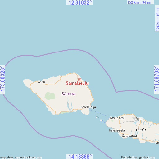
Samalaeulu GPS coordinates[2]
13° 30' 3.528" South, 172° 18' 0.54" West
| Map corner | latitude | longitude |
|---|---|---|
| Upper-left | -12.81632°, | -173.00328° |
| Center: | -13.50098°, | -172.30015° |
| Lower-right: | -14.18368°, | -171.59703° |
| Map W x H: | 152×152 km | = 94.4×94.4mi |
| max Lat: | -13.44894° ⇑4.9% North |
| Samalaeulu: | -13.50098° |
| min Lat: | ⇓95.1% South -14.04454° |
| min Long | Samalaeulu | max Long |
| -172.69436° | -172.30015° | -171.42559° |
| W 24.6%⇐ | ⇒75.4% E |
Elevation
Elevation of Samalaeulu is 38 m = 125 ft, and this is 14.1 m = 46 ft above average elevation for this country.
| Max E: |
252 m = 827 ft | 11.5% |
| Samalaeulu | 38 m 125 ft | |
| Avg. | 23.9 m = 78 ft | |
Min E: |
7 m = 23 ft | 88.5% |
See also: Samoa elevation on elevation.city.
Geographical zone
Samalaeulu is located in South Torrid zone (between Equator and Tropic of Capricorn). Distance of this Southern Tropic circle is 1104.8 km =686.5 mi to South.| Distance of | km | miles | from Samalaeulu |
|---|---|---|---|
| Equator | 1501.2 | 932.8 | to North |
| Tropic Capricorn | 1104.8 | 686.5 | to South |
| Antarctic Circle | 5900 | 3666.1 | to South |
| South Pole | 8505.9 | 5285.3 | to South |


Nearby cities:
15 places around Samalaeulu: (largest is in red/bold)
• Asau
36.6 km =22.7 mi,  266°
266°
• Auala
38.1 km =23.7 mi, 267°
• Gataivai
31.8 km =19.8 mi,  197°
197°
• Lano
16.9 km =10.5 mi,  139°
139°
• Patamea
2.7 km =1.7 mi, 195°
• Safotu
12.3 km =7.6 mi,  296°
296°
• Safotulafai
23.1 km =14.4 mi,  145°
145°
• Saipipi
18 km =11.2 mi, 142°
• Sale’aula
6.9 km =4.3 mi,  326°
326°
• Sapapali’i
23.8 km =14.8 mi, 150°
• Sasina
16.5 km =10.3 mi,  282°
282°
• Satupa‘itea
29.6 km =18.4 mi,  185°
185°
• Sa’asa’ai
19 km =11.8 mi, 142°
• Sili
29.6 km =18.4 mi, 196°
• Vailoa
28.3 km =17.6 mi,  181°
181°
Sources, notices
• [Note1] Compared only with cities in Samoa existing in our database
• [Src1] Map data: © OpenStreetMap contributors (CC-BY-SA)
• [Src2] Other city data from geonames.org with taken over terms of usage.
• [Src3] Geographical zone / Annual Mean Temperature by Robert A. Rohde @ Wikipedia
