Satupa‘itea geodata
Satupa‘itea is a seat of a first-order administrative division; located in Samoa in Pacific/Apia (GMT+13) time zone. In our database, there are 60 cities with bigger population. Compared to other cities in Samoa, 70.5% of cities are located further ↓South; 80.3% of cities are located further →East and 68.9% of cities have higher elevation than Satupa‘itea. Note1


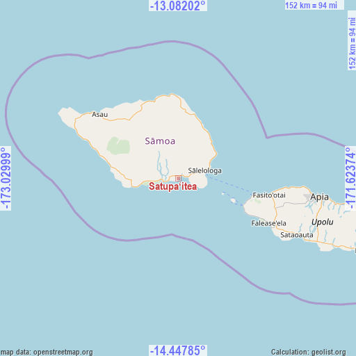
Satupa‘itea GPS coordinates[2]
13° 45' 57.348" South, 172° 19' 36.696" West
| Map corner | latitude | longitude |
|---|---|---|
| Upper-left | -13.08202°, | -173.02999° |
| Center: | -13.76593°, | -172.32686° |
| Lower-right: | -14.44785°, | -171.62374° |
| Map W x H: | 151.9×151.9 km | = 94.4×94.4mi |
| max Lat: | -13.44894° ⇑29.5% North |
| Satupa‘itea: | -13.76593° |
| min Lat: | ⇓70.5% South -14.04454° |
| min Long | Satupa‘itea | max Long |
| -172.69436° | -172.32686° | -171.42559° |
| W 19.7%⇐ | ⇒80.3% E |
Elevation
Elevation of Satupa‘itea is 11 m = 36 ft, and this is 12.9 m = 42 ft below average elevation for this country.
| Max E: |
252 m = 827 ft | 68.9% |
| Avg. | 23.9 m = 78 ft | |
| Satupa‘itea | 11 m = 36 ft | |
Min E: |
7 m = 23 ft | 31.1% |
See also: Samoa elevation on elevation.city.
Geographical zone
Satupa‘itea is located in South Torrid zone (between Equator and Tropic of Capricorn). Distance of this Southern Tropic circle is 1075.3 km =668.2 mi to South.| Distance of | km | miles | from Satupa‘itea |
|---|---|---|---|
| Equator | 1530.6 | 951.1 | to North |
| Tropic Capricorn | 1075.3 | 668.2 | to South |
| Antarctic Circle | 5870.5 | 3647.8 | to South |
| South Pole | 8476.4 | 5267 | to South |


Nearby cities:
15 places around Satupa‘itea: (largest is in red/bold)
• Gataivai
6.7 km =4.2 mi,  262°
262°
• Lano
21.5 km =13.4 mi,  39°
39°
• Mulifanua
32.2 km =20 mi,  103°
103°
• Patamea
26.9 km =16.7 mi,  4°
4°
• Safotulafai
19.2 km =11.9 mi,  56°
56°
• Sagone
32.7 km =20.3 mi,  285°
285°
• Saipipi
20.6 km =12.8 mi, 42°
• Samalaeulu
29.6 km =18.4 mi,  5°
5°
• Samatau
32.7 km =20.3 mi,  117°
117°
• Sapapali’i
17 km =10.6 mi, 59°
• Sa’asa’ai
20.3 km =12.6 mi,  45°
45°
• Sili
5.6 km =3.5 mi,  281°
281°
• Siutu
29.4 km =18.3 mi, 279°
• Taga
20.1 km =12.5 mi, 261°
• Vailoa
2.4 km =1.5 mi, 61°
Sources, notices
• [Note1] Compared only with cities in Samoa existing in our database
• [Src1] Map data: © OpenStreetMap contributors (CC-BY-SA)
• [Src2] Other city data from geonames.org with taken over terms of usage.
• [Src3] Geographical zone / Annual Mean Temperature by Robert A. Rohde @ Wikipedia
