Thamūd geodata
Thamūd (Ḩaḑramawt) is a seat of a second-order administrative division; located in Yemen in Asia/Aden (GMT+3) time zone. In our database, there are 51 cities with bigger population. Compared to other cities in Yemen, 98.4% of cities are located further ↓South; 95.1% of cities are located further ←West and 75.3% of cities have higher elevation than Thamūd. Note1


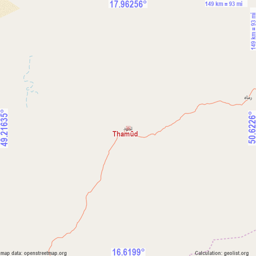
Thamūd GPS coordinates[2]
17° 17' 32.82" North, 49° 55' 10.092" East
| Map corner | latitude | longitude |
|---|---|---|
| Upper-left | 17.96256°, | 49.21635° |
| Center: | 17.29245°, | 49.91947° |
| Lower-right: | 16.6199°, | 50.6226° |
| Map W x H: | 149.3×149.3 km | = 92.8×92.8mi |
| max Lat: | 17.76999° ⇑1.6% North |
| Thamūd: | 17.29245° |
| min Lat: | ⇓98.4% South 12.18576° |
| min Long | Thamūd | max Long |
| 42.67107° | 49.91947° | 54.01895° |
| W 95.1%⇐ | ⇒4.9% E |
Elevation
Elevation of Thamūd is 661 m = 2169 ft, and this is 643.8 m = 2112 ft below average elevation for this country.
| Max E: |
2791 m = 9157 ft | 75.3% |
| Avg. | 1304.8 m = 4281 ft | |
| Thamūd | 661 m = 2169 ft | |
Min E: |
4 m = 13 ft | 24.7% |
See also: Yemen elevation on elevation.city.
Geographical zone
Thamūd is located in North Torrid zone (between Equator and Tropic of Cancer). Distance of this Northern Tropic circle is 683.2 km =424.5 mi to North.| Distance of | km | miles | from Thamūd |
|---|---|---|---|
| North Pole | 8084.3 | 5023.3 | to North |
| Arctic Circle | 5478.4 | 3404.1 | to North |
| Tropic Cancer | 683.2 | 424.5 | to North |
| Equator | 1922.7 | 1194.7 | to South |


Nearby cities:
15 places around Thamūd: (largest is in red/bold)
• Al Bilād
144.7 km =89.9 mi,  207°
207°
• Al Qaţan
224.5 km =139.5 mi,  224°
224°
• Al Qurḩ
177.5 km =110.3 mi,  110°
110°
• Al Ḩamdī
192.7 km =119.7 mi, 219°
• Al ‘Ummāl
191.1 km =118.7 mi, 218°
• As Salāsil
146.9 km =91.3 mi,  232°
232°
• At Taḩāluf
193 km =119.9 mi, 218°
• Ath Thawrah
192 km =119.3 mi, 218°
• Bāḩashawān
192.6 km =119.7 mi, 218°
• Daḩasuways
194.6 km =120.9 mi,  153°
153°
• Minwakh
200.1 km =124.3 mi,  254°
254°
• Rumāh
72.2 km =44.9 mi,  75°
75°
• Suḩayl Shibām
205.2 km =127.5 mi, 221°
• Sāh
222.2 km =138.1 mi, 210°
• Tarīm
168.8 km =104.9 mi, 215°
Sources, notices
• [Note1] Compared only with cities in Yemen existing in our database
• [Src1] Map data: © OpenStreetMap contributors (CC-BY-SA)
• [Src2] Other city data from geonames.org with taken over terms of usage.
• [Src3] Geographical zone / Annual Mean Temperature by Robert A. Rohde @ Wikipedia
