Ath Thawrah geodata
Ath Thawrah (Ḩaḑramawt) is a section of populated place; located in Yemen in Asia/Aden (GMT+3) time zone. With population of 587 people, there are 43 cities with bigger population in this country. Compared to other cities in Yemen, 79.5% of cities are located further ↓South; 91.6% of cities are located further ←West and 76.9% of cities have higher elevation than Ath Thawrah. Note1


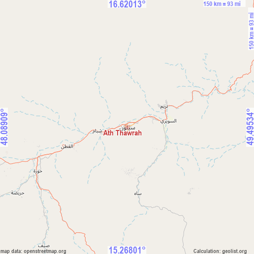
Ath Thawrah GPS coordinates[2]
15° 56' 42.756" North, 48° 47' 31.956" East
| Map corner | latitude | longitude |
|---|---|---|
| Upper-left | 16.62013°, | 48.08909° |
| Center: | 15.94521°, | 48.79221° |
| Lower-right: | 15.26801°, | 49.49534° |
| Map W x H: | 150.3×150.3 km | = 93.4×93.4mi |
| max Lat: | 17.76999° ⇑20.5% North |
| Ath Thawrah: | 15.94521° |
| min Lat: | ⇓79.5% South 12.18576° |
| min Long | Ath Thawrah | max Long |
| 42.67107° | 48.79221° | 54.01895° |
| W 91.6%⇐ | ⇒8.4% E |
Elevation
Elevation of Ath Thawrah is 648 m = 2126 ft, and this is 656.8 m = 2155 ft below average elevation for this country.
| Max E: |
2791 m = 9157 ft | 76.9% |
| Avg. | 1304.8 m = 4281 ft | |
| Ath Thawrah | 648 m = 2126 ft | |
Min E: |
4 m = 13 ft | 23.1% |
See also: Yemen elevation on elevation.city.
Geographical zone
Ath Thawrah is located in North Torrid zone (between Equator and Tropic of Cancer). Distance of this Northern Tropic circle is 833 km =517.6 mi to North.| Distance of | km | miles | from Ath Thawrah |
|---|---|---|---|
| North Pole | 8234.1 | 5116.4 | to North |
| Arctic Circle | 5628.2 | 3497.2 | to North |
| Tropic Cancer | 833 | 517.6 | to North |
| Equator | 1772.9 | 1101.6 | to South |


Nearby cities:
15 places around Ath Thawrah: (largest is in red/bold)
• Al Bilād
57.5 km =35.7 mi,  68°
68°
• Al Bāţinah
64.1 km =39.8 mi,  216°
216°
• Al Qaţan
37.8 km =23.5 mi,  252°
252°
• Al Ḩamdī
1.4 km =0.9 mi,  279°
279°
• Al ‘Ulayb
93.7 km =58.2 mi,  161°
161°
• Al ‘Ummāl
1.2 km =0.7 mi,  79°
79°
• As Salāsil
59.6 km =37 mi,  4°
4°
• At Taḩāluf
1 km =0.6 mi, 217°
• Bāḩashawān
0.8 km =0.5 mi, 249°
• Suḩayl Shibām
16.8 km =10.4 mi,  258°
258°
• Sāh
41.4 km =25.7 mi,  171°
171°
• Tarīm
25.3 km =15.7 mi,  60°
60°
• Şīf
85.9 km =53.4 mi, 215°
• Ḩajar al Mashā’ikh
104.8 km =65.1 mi, 281°
• Ḩurayḑah
75.7 km =47 mi,  239°
239°
Sources, notices
• [Note1] Compared only with cities in Yemen existing in our database
• [Src1] Map data: © OpenStreetMap contributors (CC-BY-SA)
• [Src2] Other city data from geonames.org with taken over terms of usage.
• [Src3] Geographical zone / Annual Mean Temperature by Robert A. Rohde @ Wikipedia
