Rumāh geodata
Rumāh (Ḩaḑramawt) is a seat of a second-order administrative division; located in Yemen in Asia/Aden (GMT+3) time zone. In our database, there are 51 cities with bigger population. Compared to other cities in Yemen, 99.7% of cities are located further ↓South; 96.1% of cities are located further ←West and 73.4% of cities have higher elevation than Rumāh. Note1


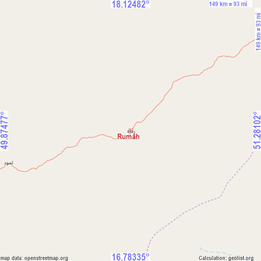
Rumāh GPS coordinates[2]
17° 27' 19.152" North, 50° 34' 40.404" East
| Map corner | latitude | longitude |
|---|---|---|
| Upper-left | 18.12482°, | 49.87477° |
| Center: | 17.45532°, | 50.57789° |
| Lower-right: | 16.78335°, | 51.28102° |
| Map W x H: | 149.2×149.2 km | = 92.7×92.7mi |
| max Lat: | 17.76999° ⇑0.3% North |
| Rumāh: | 17.45532° |
| min Lat: | ⇓99.7% South 12.18576° |
| min Long | Rumāh | max Long |
| 42.67107° | 50.57789° | 54.01895° |
| W 96.1%⇐ | ⇒3.9% E |
Elevation
Elevation of Rumāh is 697 m = 2287 ft, and this is 607.8 m = 1994 ft below average elevation for this country.
| Max E: |
2791 m = 9157 ft | 73.4% |
| Avg. | 1304.8 m = 4281 ft | |
| Rumāh | 697 m = 2287 ft | |
Min E: |
4 m = 13 ft | 26.6% |
See also: Yemen elevation on elevation.city.
Geographical zone
Rumāh is located in North Torrid zone (between Equator and Tropic of Cancer). Distance of this Northern Tropic circle is 665.1 km =413.3 mi to North.| Distance of | km | miles | from Rumāh |
|---|---|---|---|
| North Pole | 8066.2 | 5012.1 | to North |
| Arctic Circle | 5460.3 | 3392.9 | to North |
| Tropic Cancer | 665.1 | 413.3 | to North |
| Equator | 1940.8 | 1206 | to South |


Nearby cities:
15 places around Rumāh: (largest is in red/bold)
• Al Bilād
200.5 km =124.6 mi,  223°
223°
• Al Ghayz̧ah
219.5 km =136.4 mi,  129°
129°
• Al Qurḩ
125.3 km =77.9 mi, 129°
• Al Ḩamdī
254.5 km =158.1 mi,  228°
228°
• Al ‘Ummāl
252.7 km =157 mi, 228°
• As Salāsil
215.1 km =133.7 mi,  239°
239°
• At Taḩāluf
254.7 km =158.3 mi, 228°
• Ath Thawrah
253.7 km =157.6 mi, 228°
• Bi’r Ḩāt
161.7 km =100.5 mi,  95°
95°
• Bāḩashawān
254.4 km =158.1 mi, 228°
• Daḩasuways
193.2 km =120 mi,  175°
175°
• Qishn
254.5 km =158.1 mi,  152°
152°
• Shiḩan as Suflá
205.6 km =127.8 mi,  80°
80°
• Tarīm
229 km =142.3 mi, 227°
• Thamūd
72.2 km =44.9 mi,  255°
255°
Sources, notices
• [Note1] Compared only with cities in Yemen existing in our database
• [Src1] Map data: © OpenStreetMap contributors (CC-BY-SA)
• [Src2] Other city data from geonames.org with taken over terms of usage.
• [Src3] Geographical zone / Annual Mean Temperature by Robert A. Rohde @ Wikipedia
