Al Qurḩ geodata
Al Qurḩ (Al Mahrah) is a seat of a second-order administrative division; located in Yemen in Asia/Aden (GMT+3) time zone. In our database, there are 51 cities with bigger population. Compared to other cities in Yemen, 93.8% of cities are located further ↓South; 97.1% of cities are located further ←West and 78.2% of cities have higher elevation than Al Qurḩ. Note1


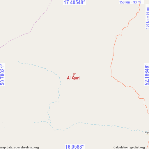
Al Qurḩ GPS coordinates[2]
16° 43' 59.988" North, 51° 28' 59.988" East
| Map corner | latitude | longitude |
|---|---|---|
| Upper-left | 17.40548°, | 50.78021° |
| Center: | 16.73333°, | 51.48333° |
| Lower-right: | 16.0588°, | 52.18646° |
| Map W x H: | 149.7×149.7 km | = 93×93mi |
| max Lat: | 17.76999° ⇑6.2% North |
| Al Qurḩ: | 16.73333° |
| min Lat: | ⇓93.8% South 12.18576° |
| min Long | Al Qurḩ | max Long |
| 42.67107° | 51.48333° | 54.01895° |
| W 97.1%⇐ | ⇒2.9% E |
Elevation
Elevation of Al Qurḩ is 621 m = 2037 ft, and this is 683.8 m = 2243 ft below average elevation for this country.
| Max E: |
2791 m = 9157 ft | 78.2% |
| Avg. | 1304.8 m = 4281 ft | |
| Al Qurḩ | 621 m = 2037 ft | |
Min E: |
4 m = 13 ft | 21.8% |
See also: Yemen elevation on elevation.city.
Geographical zone
Al Qurḩ is located in North Torrid zone (between Equator and Tropic of Cancer). Distance of this Northern Tropic circle is 745.3 km =463.1 mi to North.| Distance of | km | miles | from Al Qurḩ |
|---|---|---|---|
| North Pole | 8146.5 | 5062 | to North |
| Arctic Circle | 5540.6 | 3442.8 | to North |
| Tropic Cancer | 745.3 | 463.1 | to North |
| Equator | 1860.6 | 1156.1 | to South |


Nearby cities:
15 places around Al Qurḩ: (largest is in red/bold)
• Ad Dīs ash Sharqīyah
261 km =162.2 mi,  218°
218°
• Al Bilād
242.9 km =150.9 mi,  254°
254°
• Al Ghayz̧ah
94.2 km =58.5 mi,  128°
128°
• Ar Raydah
217.2 km =135 mi,  209°
209°
• As Salāsil
284 km =176.5 mi,  264°
264°
• Bi’r Ḩāt
92.3 km =57.4 mi,  44°
44°
• Daḩasuways
138.1 km =85.8 mi, 215°
• Qishn
147.1 km =91.4 mi,  171°
171°
• Rumāh
125.3 km =77.9 mi,  309°
309°
• Sayḩūt
171.2 km =106.4 mi,  188°
188°
• Shiḩan as Suflá
157.1 km =97.6 mi, 42°
• Tarīm
275.5 km =171.2 mi, 254°
• Thamūd
177.5 km =110.3 mi,  290°
290°
• Ḩawf
165.5 km =102.8 mi,  93°
93°
• Ḩaşwayn
143.2 km =89 mi,  152°
152°
Sources, notices
• [Note1] Compared only with cities in Yemen existing in our database
• [Src1] Map data: © OpenStreetMap contributors (CC-BY-SA)
• [Src2] Other city data from geonames.org with taken over terms of usage.
• [Src3] Geographical zone / Annual Mean Temperature by Robert A. Rohde @ Wikipedia
