Sayyān geodata
Sayyān (Sanaa) is a seat of a second-order administrative division; located in Yemen in Asia/Aden (GMT+3) time zone. With population of 69,404 people, there are 8 cities with bigger population in this country. Compared to other cities in Yemen, 55.8% of cities are located further ↓South; 50.6% of cities are located further →East and 96.1% of cities have lower elevation than Sayyān. Note1


Sayyān GPS coordinates[2]
15° 10' 18.372" North, 44° 19' 27.912" East
| Map corner | latitude | longitude |
|---|---|---|
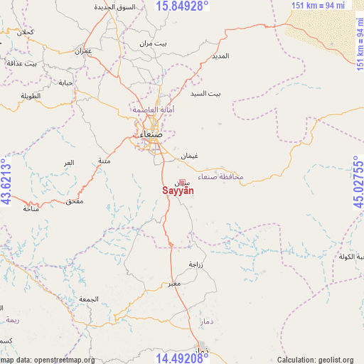
| Upper-left | 15.84928°, | 43.6213° |
| Center: | 15.17177°, | 44.32442° |
| Lower-right: | 14.49208°, | 45.02755° |
| Map W x H: | 150.9×150.9 km | = 93.8×93.8mi |
| max Lat: | 17.76999° ⇑44.2% North |
| Sayyān: | 15.17177° |
| min Lat: | ⇓55.8% South 12.18576° |
| min Long | Sayyān | max Long |
| 42.67107° | 44.32442° | 54.01895° |
| W 49.4%⇐ | ⇒50.6% E |
Elevation
Elevation of Sayyān is 2482 m = 8143 ft, and this is 1177.2 m = 3862 ft above average elevation for this country.
| Max E: |
2791 m = 9157 ft | 3.9% |
| Sayyān | 2482 m 8143 ft | |
| Avg. | 1304.8 m = 4281 ft | |
Min E: |
4 m = 13 ft | 96.1% |
See also: Sayyān elevation on elevation.city.
Geographical zone
Sayyān is located in North Torrid zone (between Equator and Tropic of Cancer). Distance of this Northern Tropic circle is 919 km =571 mi to North.| Distance of | km | miles | from Sayyān |
|---|---|---|---|
| North Pole | 8320.1 | 5169.9 | to North |
| Arctic Circle | 5714.2 | 3550.6 | to North |
| Tropic Cancer | 919 | 571 | to North |
| Equator | 1686.9 | 1048.2 | to South |


Nearby cities:
15 places around Sayyān: (largest is in red/bold)
• Al Khāniq
39.8 km =24.7 mi,  337°
337°
• Al ‘Urr
47.5 km =29.5 mi,  280°
280°
• Ar Rawḑah
30.9 km =19.2 mi, 339°
• Bidbadah
49.1 km =30.5 mi,  55°
55°
• Jadder Cemetery
36.4 km =22.6 mi,  334°
334°
• Jiḩānah
18 km =11.2 mi,  70°
70°
• Mafḩaq
45.9 km =28.5 mi,  260°
260°
• Matnah
33.4 km =20.8 mi,  285°
285°
• Ma‘bar
42.1 km =26.2 mi,  184°
184°
• Qaryat al Qābil
37.5 km =23.3 mi, 325°
• Sanaa
23.9 km =14.9 mi, 328°
• Saḩar
16.2 km =10.1 mi,  354°
354°
• Wa‘lān
12.4 km =7.7 mi,  204°
204°
• Zarājah
34.4 km =21.4 mi,  170°
170°
• Ḑawrān ad Daydah
49.7 km =30.9 mi,  194°
194°
Sources, notices
• [Note1] Compared only with cities in Yemen existing in our database
• [Src1] Map data: © OpenStreetMap contributors (CC-BY-SA)
• [Src2] Other city data from geonames.org with taken over terms of usage.
• [Src3] Geographical zone / Annual Mean Temperature by Robert A. Rohde @ Wikipedia
