Qaryat al Qābil geodata
Qaryat al Qābil (Amanat Al Asimah) is a seat of a second-order administrative division; located in Yemen in Asia/Aden (GMT+3) time zone. In our database, there are 51 cities with bigger population. Compared to other cities in Yemen, 63.3% of cities are located further ↓South; 60.1% of cities are located further →East and 88.3% of cities have lower elevation than Qaryat al Qābil. Note1


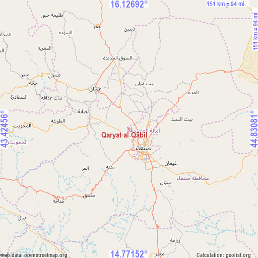
Qaryat al Qābil GPS coordinates[2]
15° 27' 1.188" North, 44° 7' 39.648" East
| Map corner | latitude | longitude |
|---|---|---|
| Upper-left | 16.12692°, | 43.42456° |
| Center: | 15.45033°, | 44.12768° |
| Lower-right: | 14.77152°, | 44.83081° |
| Map W x H: | 150.7×150.7 km | = 93.6×93.6mi |
| max Lat: | 17.76999° ⇑36.7% North |
| Qaryat al Qābil: | 15.45033° |
| min Lat: | ⇓63.3% South 12.18576° |
| min Long | Qaryat al Qābi | max Long |
| 42.67107° | 44.12768° | 54.01895° |
| W 39.9%⇐ | ⇒60.1% E |
Elevation
Elevation of Qaryat al Qābil is 2250 m = 7382 ft, and this is 945.2 m = 3101 ft above average elevation for this country.
| Max E: |
2791 m = 9157 ft | 11.7% |
| Qaryat al Qābil | 2250 m 7382 ft | |
| Avg. | 1304.8 m = 4281 ft | |
Min E: |
4 m = 13 ft | 88.3% |
See also: Yemen elevation on elevation.city.
Geographical zone
Qaryat al Qābil is located in North Torrid zone (between Equator and Tropic of Cancer). Distance of this Northern Tropic circle is 888 km =551.8 mi to North.| Distance of | km | miles | from Qaryat al Qābil |
|---|---|---|---|
| North Pole | 8289.1 | 5150.6 | to North |
| Arctic Circle | 5683.3 | 3531.4 | to North |
| Tropic Cancer | 888 | 551.8 | to North |
| Equator | 1717.9 | 1067.5 | to South |


Nearby cities:
15 places around Qaryat al Qābil: (largest is in red/bold)
• Al Khāniq
8.2 km =5.1 mi,  44°
44°
• Al Ḩayfah
33.8 km =21 mi,  20°
20°
• Al ‘Urr
34.2 km =21.3 mi,  228°
228°
• Ar Rawḑah
10.5 km =6.5 mi,  100°
100°
• Aţ Ţawīlah
41 km =25.5 mi,  276°
276°
• Bayt Marrān
28.2 km =17.5 mi, 17°
• Jadder Cemetery
5.7 km =3.5 mi,  70°
70°
• Matnah
24.5 km =15.2 mi,  206°
206°
• Sanaa
13.6 km =8.5 mi,  141°
141°
• Sayyān
37.5 km =23.3 mi,  145°
145°
• Saḩar
24.5 km =15.2 mi,  127°
127°
• Saḩḩab
20.2 km =12.6 mi,  326°
326°
• Shibām
24.8 km =15.4 mi,  285°
285°
• Ḩabābah
29 km =18 mi, 291°
• ‘Amrān
30.5 km =19 mi,  319°
319°
Sources, notices
• [Note1] Compared only with cities in Yemen existing in our database
• [Src1] Map data: © OpenStreetMap contributors (CC-BY-SA)
• [Src2] Other city data from geonames.org with taken over terms of usage.
• [Src3] Geographical zone / Annual Mean Temperature by Robert A. Rohde @ Wikipedia
