Saḩar geodata
Saḩar (Sanaa) is a populated place; located in Yemen in Asia/Aden (GMT+3) time zone. With population of 31,859 people, there are 18 cities with bigger population in this country. Compared to other cities in Yemen, 59.4% of cities are located further ↓South; 51.3% of cities are located further →East and 91.9% of cities have lower elevation than Saḩar. Note1


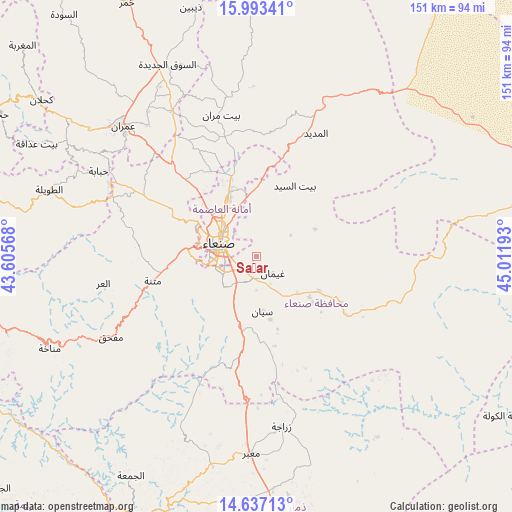
Saḩar GPS coordinates[2]
15° 18' 58.932" North, 44° 18' 31.68" East
| Map corner | latitude | longitude |
|---|---|---|
| Upper-left | 15.99341°, | 43.60568° |
| Center: | 15.31637°, | 44.3088° |
| Lower-right: | 14.63713°, | 45.01193° |
| Map W x H: | 150.8×150.8 km | = 93.7×93.7mi |
| max Lat: | 17.76999° ⇑40.6% North |
| Saḩar: | 15.31637° |
| min Lat: | ⇓59.4% South 12.18576° |
| min Long | Saḩar | max Long |
| 42.67107° | 44.3088° | 54.01895° |
| W 48.7%⇐ | ⇒51.3% E |
Elevation
Elevation of Saḩar is 2372 m = 7782 ft, and this is 1067.2 m = 3501 ft above average elevation for this country.
| Max E: |
2791 m = 9157 ft | 8.1% |
| Saḩar | 2372 m 7782 ft | |
| Avg. | 1304.8 m = 4281 ft | |
Min E: |
4 m = 13 ft | 91.9% |
See also: Yemen elevation on elevation.city.
Geographical zone
Saḩar is located in North Torrid zone (between Equator and Tropic of Cancer). Distance of this Northern Tropic circle is 902.9 km =561 mi to North.| Distance of | km | miles | from Saḩar |
|---|---|---|---|
| North Pole | 8304 | 5159.9 | to North |
| Arctic Circle | 5698.2 | 3540.7 | to North |
| Tropic Cancer | 902.9 | 561 | to North |
| Equator | 1703 | 1058.2 | to South |


Nearby cities:
15 places around Saḩar: (largest is in red/bold)
• Al Khāniq
24.8 km =15.4 mi,  326°
326°
• Al Madīd
40.5 km =25.2 mi,  25°
25°
• Al Ḩarjah
42.8 km =26.6 mi,  63°
63°
• Al ‘Urr
45.8 km =28.5 mi,  260°
260°
• Ar Rawḑah
15.8 km =9.8 mi,  324°
324°
• Bayt Marrān
43.3 km =26.9 mi,  345°
345°
• Bidbadah
43.6 km =27.1 mi,  73°
73°
• Jadder Cemetery
21.9 km =13.6 mi, 320°
• Jiḩānah
21.1 km =13.1 mi,  118°
118°
• Matnah
31.3 km =19.4 mi, 257°
• Qaryat al Qābil
24.5 km =15.2 mi,  307°
307°
• Sanaa
11.8 km =7.3 mi,  291°
291°
• Sayyān
16.2 km =10.1 mi,  174°
174°
• Saḩḩab
44.1 km =27.4 mi, 316°
• Wa‘lān
27.6 km =17.1 mi,  187°
187°
Sources, notices
• [Note1] Compared only with cities in Yemen existing in our database
• [Src1] Map data: © OpenStreetMap contributors (CC-BY-SA)
• [Src2] Other city data from geonames.org with taken over terms of usage.
• [Src3] Geographical zone / Annual Mean Temperature by Robert A. Rohde @ Wikipedia
