Al Madīd geodata
Al Madīd (Sanaa) is a seat of a second-order administrative division; located in Yemen in Asia/Aden (GMT+3) time zone. In our database, there are 51 cities with bigger population. Compared to other cities in Yemen, 71.1% of cities are located further ↓South; 52.9% of cities are located further ←West and 78.6% of cities have lower elevation than Al Madīd. Note1


Al Madīd GPS coordinates[2]
15° 38' 40.308" North, 44° 28' 24.132" East
| Map corner | latitude | longitude |
|---|---|---|
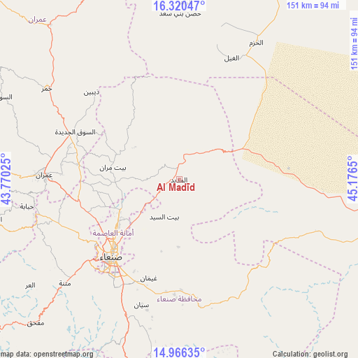
| Upper-left | 16.32047°, | 43.77025° |
| Center: | 15.64453°, | 44.47337° |
| Lower-right: | 14.96635°, | 45.1765° |
| Map W x H: | 150.6×150.6 km | = 93.6×93.6mi |
| max Lat: | 17.76999° ⇑28.9% North |
| Al Madīd: | 15.64453° |
| min Lat: | ⇓71.1% South 12.18576° |
| min Long | Al Madīd | max Long |
| 42.67107° | 44.47337° | 54.01895° |
| W 52.9%⇐ | ⇒47.1% E |
Elevation
Elevation of Al Madīd is 2091 m = 6860 ft, and this is 786.2 m = 2579 ft above average elevation for this country.
| Max E: |
2791 m = 9157 ft | 21.4% |
| Al Madīd | 2091 m 6860 ft | |
| Avg. | 1304.8 m = 4281 ft | |
Min E: |
4 m = 13 ft | 78.6% |
See also: Yemen elevation on elevation.city.
Geographical zone
Al Madīd is located in North Torrid zone (between Equator and Tropic of Cancer). Distance of this Northern Tropic circle is 866.4 km =538.4 mi to North.| Distance of | km | miles | from Al Madīd |
|---|---|---|---|
| North Pole | 8267.6 | 5137.2 | to North |
| Arctic Circle | 5661.7 | 3518 | to North |
| Tropic Cancer | 866.4 | 538.4 | to North |
| Equator | 1739.5 | 1080.9 | to South |


Nearby cities:
15 places around Al Madīd: (largest is in red/bold)
• Al Khāniq
35 km =21.7 mi,  243°
243°
• Al Ḩarjah
26.9 km =16.7 mi,  130°
130°
• Al Ḩayfah
27.1 km =16.8 mi,  291°
291°
• Ar Rawḑah
35.6 km =22.1 mi,  228°
228°
• As Sūq al Jadīd
48.4 km =30.1 mi, 294°
• Bayt Marrān
29.2 km =18.1 mi,  280°
280°
• Bidbadah
34.4 km =21.4 mi,  135°
135°
• Jadder Cemetery
37.3 km =23.2 mi, 238°
• Jiḩānah
46.5 km =28.9 mi,  178°
178°
• Majzar
39.5 km =24.5 mi,  54°
54°
• Qaryat al Qābil
42.9 km =26.7 mi, 239°
• Raydah
50 km =31.1 mi, 292°
• Sanaa
43.1 km =26.8 mi,  221°
221°
• Saḩar
40.5 km =25.2 mi,  205°
205°
• Saḩḩab
48.3 km =30 mi,  264°
264°
Sources, notices
• [Note1] Compared only with cities in Yemen existing in our database
• [Src1] Map data: © OpenStreetMap contributors (CC-BY-SA)
• [Src2] Other city data from geonames.org with taken over terms of usage.
• [Src3] Geographical zone / Annual Mean Temperature by Robert A. Rohde @ Wikipedia
