Banī Ḩujjāj geodata
Banī Ḩujjāj (Al Maḩwīt) is a seat of a second-order administrative division; located in Yemen in Asia/Aden (GMT+3) time zone. In our database, there are 51 cities with bigger population. Compared to other cities in Yemen, 61.7% of cities are located further ↓South; 92.2% of cities are located further →East and 72.1% of cities have higher elevation than Banī Ḩujjāj. Note1


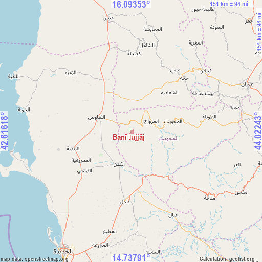
Banī Ḩujjāj GPS coordinates[2]
15° 25' 0.588" North, 43° 19' 9.48" East
| Map corner | latitude | longitude |
|---|---|---|
| Upper-left | 16.09353°, | 42.61618° |
| Center: | 15.41683°, | 43.3193° |
| Lower-right: | 14.73791°, | 44.02243° |
| Map W x H: | 150.7×150.7 km | = 93.6×93.6mi |
| max Lat: | 17.76999° ⇑38.3% North |
| Banī Ḩujjāj: | 15.41683° |
| min Lat: | ⇓61.7% South 12.18576° |
| min Long | Banī Ḩujjāj | max Long |
| 42.67107° | 43.3193° | 54.01895° |
| W 7.8%⇐ | ⇒92.2% E |
Elevation
Elevation of Banī Ḩujjāj is 745 m = 2444 ft, and this is 559.8 m = 1837 ft below average elevation for this country.
| Max E: |
2791 m = 9157 ft | 72.1% |
| Avg. | 1304.8 m = 4281 ft | |
| Banī Ḩujjāj | 745 m = 2444 ft | |
Min E: |
4 m = 13 ft | 27.9% |
See also: Yemen elevation on elevation.city.
Geographical zone
Banī Ḩujjāj is located in North Torrid zone (between Equator and Tropic of Cancer). Distance of this Northern Tropic circle is 891.7 km =554.1 mi to North.| Distance of | km | miles | from Banī Ḩujjāj |
|---|---|---|---|
| North Pole | 8292.9 | 5153 | to North |
| Arctic Circle | 5687 | 3533.7 | to North |
| Tropic Cancer | 891.7 | 554.1 | to North |
| Equator | 1714.2 | 1065.2 | to South |


Nearby cities:
15 places around Banī Ḩujjāj: (largest is in red/bold)
• Al Khamīs
33 km =20.5 mi,  141°
141°
• Al Maḩwīt
24.9 km =15.5 mi,  76°
76°
• Al Mighlāf
20 km =12.4 mi,  224°
224°
• Al Mirwāḩ
13.3 km =8.3 mi,  62°
62°
• Al Munīrah
43 km =26.7 mi,  255°
255°
• Al Qanāwiş
21.6 km =13.4 mi,  293°
293°
• Ar Rujum
33.8 km =21 mi, 82°
• Ash Shaghādirah
31.2 km =19.4 mi,  43°
43°
• Az Zaydīyah
34.9 km =21.7 mi,  254°
254°
• Aş Şafaqayn
11.6 km =7.2 mi,  111°
111°
• Banī al ‘Awwām
34 km =21.1 mi, 57°
• Banī an Nahārī
35.5 km =22.1 mi,  45°
45°
• Bājil
39.9 km =24.8 mi,  184°
184°
• Dhahi
34.9 km =21.7 mi,  229°
229°
• Waḑarah
37.1 km =23.1 mi,  28°
28°
Sources, notices
• [Note1] Compared only with cities in Yemen existing in our database
• [Src1] Map data: © OpenStreetMap contributors (CC-BY-SA)
• [Src2] Other city data from geonames.org with taken over terms of usage.
• [Src3] Geographical zone / Annual Mean Temperature by Robert A. Rohde @ Wikipedia
