Al Mighlāf geodata
Al Mighlāf (Al Hudaydah) is a seat of a second-order administrative division; located in Yemen in Asia/Aden (GMT+3) time zone. In our database, there are 51 cities with bigger population. Compared to other cities in Yemen, 58.1% of cities are located further ↓South; 96.1% of cities are located further →East and 86.4% of cities have higher elevation than Al Mighlāf. Note1


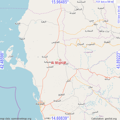
Al Mighlāf GPS coordinates[2]
15° 17' 15.792" North, 43° 11' 20.76" East
| Map corner | latitude | longitude |
|---|---|---|
| Upper-left | 15.96485°, | 42.48598° |
| Center: | 15.28772°, | 43.1891° |
| Lower-right: | 14.60839°, | 43.89223° |
| Map W x H: | 150.8×150.8 km | = 93.7×93.7mi |
| max Lat: | 17.76999° ⇑41.9% North |
| Al Mighlāf: | 15.28772° |
| min Lat: | ⇓58.1% South 12.18576° |
| min Long | Al Mighlāf | max Long |
| 42.67107° | 43.1891° | 54.01895° |
| W 3.9%⇐ | ⇒96.1% E |
Elevation
Elevation of Al Mighlāf is 132 m = 433 ft, and this is 1172.8 m = 3848 ft below average elevation for this country.
| Max E: |
2791 m = 9157 ft | 86.4% |
| Avg. | 1304.8 m = 4281 ft | |
| Al Mighlāf | 132 m = 433 ft | |
Min E: |
4 m = 13 ft | 13.6% |
See also: Yemen elevation on elevation.city.
Geographical zone
Al Mighlāf is located in North Torrid zone (between Equator and Tropic of Cancer). Distance of this Northern Tropic circle is 906.1 km =563 mi to North.| Distance of | km | miles | from Al Mighlāf |
|---|---|---|---|
| North Pole | 8307.2 | 5161.9 | to North |
| Arctic Circle | 5701.3 | 3542.6 | to North |
| Tropic Cancer | 906.1 | 563 | to North |
| Equator | 1699.8 | 1056.2 | to South |


Nearby cities:
15 places around Al Mighlāf: (largest is in red/bold)
• Al Khamīs
36.4 km =22.6 mi,  108°
108°
• Al Marāwi‘ah
51 km =31.7 mi,  184°
184°
• Al Maḩwīt
43.2 km =26.8 mi,  62°
62°
• Al Mirwāḩ
32.9 km =20.4 mi,  51°
51°
• Al Munīrah
28.1 km =17.5 mi,  277°
277°
• Al Qanāwiş
23.6 km =14.7 mi,  345°
345°
• Ar Rujum
51.1 km =31.8 mi,  68°
68°
• Ash Shaghādirah
51.3 km =31.9 mi,  43°
43°
• Az Zaydīyah
20.2 km =12.6 mi, 283°
• Az Zuhrah
52.7 km =32.7 mi,  336°
336°
• Aş Şafaqayn
26.8 km =16.7 mi, 67°
• Banī Ḩujjāj
20 km =12.4 mi, 44°
• Bājil
27.5 km =17.1 mi,  157°
157°
• Dhahi
15.1 km =9.4 mi,  237°
237°
• ‘Ubāl
50.6 km =31.4 mi,  131°
131°
Sources, notices
• [Note1] Compared only with cities in Yemen existing in our database
• [Src1] Map data: © OpenStreetMap contributors (CC-BY-SA)
• [Src2] Other city data from geonames.org with taken over terms of usage.
• [Src3] Geographical zone / Annual Mean Temperature by Robert A. Rohde @ Wikipedia
