Al Makhādir geodata
Al Makhādir (Ibb) is a seat of a second-order administrative division; located in Yemen in Asia/Aden (GMT+3) time zone. In our database, there are 51 cities with bigger population. Compared to other cities in Yemen, 71.1% of cities are located further ↑North; 56.2% of cities are located further →East and 64% of cities have lower elevation than Al Makhādir. Note1


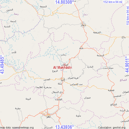
Al Makhādir GPS coordinates[2]
14° 7' 20.064" North, 44° 11' 52.692" East
| Map corner | latitude | longitude |
|---|---|---|
| Upper-left | 14.80308°, | 43.49485° |
| Center: | 14.12224°, | 44.19797° |
| Lower-right: | 13.43936°, | 44.9011° |
| Map W x H: | 151.6×151.6 km | = 94.2×94.2mi |
| max Lat: | 17.76999° ⇑71.1% North |
| Al Makhādir: | 14.12224° |
| min Lat: | ⇓28.9% South 12.18576° |
| min Long | Al Makhādir | max Long |
| 42.67107° | 44.19797° | 54.01895° |
| W 43.8%⇐ | ⇒56.2% E |
Elevation
Elevation of Al Makhādir is 1725 m = 5659 ft, and this is 420.2 m = 1379 ft above average elevation for this country.
| Max E: |
2791 m = 9157 ft | 36% |
| Al Makhādir | 1725 m 5659 ft | |
| Avg. | 1304.8 m = 4281 ft | |
Min E: |
4 m = 13 ft | 64% |
See also: Yemen elevation on elevation.city.
Geographical zone
Al Makhādir is located in North Torrid zone (between Equator and Tropic of Cancer). Distance of this Northern Tropic circle is 1035.7 km =643.6 mi to North.| Distance of | km | miles | from Al Makhādir |
|---|---|---|---|
| North Pole | 8436.8 | 5242.4 | to North |
| Arctic Circle | 5830.9 | 3623.2 | to North |
| Tropic Cancer | 1035.7 | 643.6 | to North |
| Equator | 1570.2 | 975.7 | to South |


Nearby cities:
15 places around Al Makhādir: (largest is in red/bold)
• Al ‘Udayn
27.6 km =17.1 mi,  231°
231°
• An Nādirah
30.1 km =18.7 mi,  95°
95°
• Ar Riḑā’ī
24.2 km =15 mi,  118°
118°
• As Saddah
24.1 km =15 mi,  90°
90°
• As Sayyānī
31.2 km =19.4 mi,  184°
184°
• Dhī as Sufāl
33.2 km =20.6 mi,  195°
195°
• Ibb
17.4 km =10.8 mi,  185°
185°
• Jiblah
23 km =14.3 mi, 193°
• Markaz Mudhaykirah
35.8 km =22.2 mi,  223°
223°
• Najd al Jamā‘ī
26.7 km =16.6 mi,  149°
149°
• Qaryat ad Da‘īs
17.1 km =10.6 mi, 150°
• Riḩāb
11.8 km =7.3 mi,  354°
354°
• Yarīm
27.5 km =17.1 mi,  44°
44°
• Z̧almah al ‘Ulyā
11.4 km =7.1 mi,  258°
258°
• Ḩazm al ‘Udayn
23.3 km =14.5 mi,  243°
243°
Sources, notices
• [Note1] Compared only with cities in Yemen existing in our database
• [Src1] Map data: © OpenStreetMap contributors (CC-BY-SA)
• [Src2] Other city data from geonames.org with taken over terms of usage.
• [Src3] Geographical zone / Annual Mean Temperature by Robert A. Rohde @ Wikipedia
