Ḩazm al ‘Udayn geodata
Ḩazm al ‘Udayn (Ibb) is a seat of a second-order administrative division; located in Yemen in Asia/Aden (GMT+3) time zone. In our database, there are 51 cities with bigger population. Compared to other cities in Yemen, 74% of cities are located further ↑North; 65.3% of cities are located further →East and 78.9% of cities have lower elevation than Ḩazm al ‘Udayn. Note1


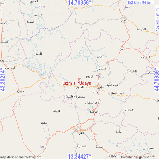
Ḩazm al ‘Udayn GPS coordinates[2]
14° 1' 38.748" North, 44° 0' 18.936" East
| Map corner | latitude | longitude |
|---|---|---|
| Upper-left | 14.70856°, | 43.30214° |
| Center: | 14.02743°, | 44.00526° |
| Lower-right: | 13.34427°, | 44.70839° |
| Map W x H: | 151.7×151.7 km | = 94.3×94.3mi |
| max Lat: | 17.76999° ⇑74% North |
| Ḩazm al ‘Udayn: | 14.02743° |
| min Lat: | ⇓26% South 12.18576° |
| min Long | Ḩazm al ‘Ud | max Long |
| 42.67107° | 44.00526° | 54.01895° |
| W 34.7%⇐ | ⇒65.3% E |
Elevation
Elevation of Ḩazm al ‘Udayn is 2099 m = 6886 ft, and this is 794.2 m = 2606 ft above average elevation for this country.
| Max E: |
2791 m = 9157 ft | 21.1% |
| Ḩazm al ‘Udayn | 2099 m 6886 ft | |
| Avg. | 1304.8 m = 4281 ft | |
Min E: |
4 m = 13 ft | 78.9% |
See also: Yemen elevation on elevation.city.
Geographical zone
Ḩazm al ‘Udayn is located in North Torrid zone (between Equator and Tropic of Cancer). Distance of this Northern Tropic circle is 1046.2 km =650.1 mi to North.| Distance of | km | miles | from Ḩazm al ‘Udayn |
|---|---|---|---|
| North Pole | 8447.4 | 5249 | to North |
| Arctic Circle | 5841.5 | 3629.7 | to North |
| Tropic Cancer | 1046.2 | 650.1 | to North |
| Equator | 1559.7 | 969.2 | to South |


Nearby cities:
15 places around Ḩazm al ‘Udayn: (largest is in red/bold)
• Ad Dann
39.6 km =24.6 mi,  335°
335°
• Al Makhādir
23.3 km =14.5 mi,  63°
63°
• Al ‘Udayn
6.5 km =4 mi,  188°
188°
• Ar Ramādī
25.1 km =15.6 mi,  251°
251°
• Ar Rawnah
37.2 km =23.1 mi,  215°
215°
• Ar Rubū‘
31.2 km =19.4 mi,  208°
208°
• As Sayyānī
27.4 km =17 mi,  138°
138°
• Dhī as Sufāl
24.5 km =15.2 mi,  151°
151°
• Ibb
20.4 km =12.7 mi,  109°
109°
• Jiblah
19.3 km =12 mi,  127°
127°
• Markaz Mudhaykirah
15.8 km =9.8 mi, 194°
• Najd al Jamā‘ī
36.6 km =22.7 mi, 109°
• Qaryat ad Da‘īs
29.4 km =18.3 mi,  98°
98°
• Riḩāb
29.7 km =18.5 mi,  41°
41°
• Z̧almah al ‘Ulyā
12.7 km =7.9 mi,  48°
48°
Sources, notices
• [Note1] Compared only with cities in Yemen existing in our database
• [Src1] Map data: © OpenStreetMap contributors (CC-BY-SA)
• [Src2] Other city data from geonames.org with taken over terms of usage.
• [Src3] Geographical zone / Annual Mean Temperature by Robert A. Rohde @ Wikipedia
