Najd al Jamā‘ī geodata
Najd al Jamā‘ī (Ibb) is a seat of a second-order administrative division; located in Yemen in Asia/Aden (GMT+3) time zone. In our database, there are 51 cities with bigger population. Compared to other cities in Yemen, 78.9% of cities are located further ↑North; 50.3% of cities are located further →East and 72.1% of cities have lower elevation than Najd al Jamā‘ī. Note1


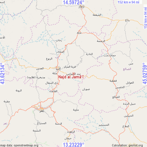
Najd al Jamā‘ī GPS coordinates[2]
13° 54' 56.772" North, 44° 19' 28.056" East
| Map corner | latitude | longitude |
|---|---|---|
| Upper-left | 14.59724°, | 43.62134° |
| Center: | 13.91577°, | 44.32446° |
| Lower-right: | 13.23229°, | 45.02759° |
| Map W x H: | 151.8×151.8 km | = 94.3×94.3mi |
| max Lat: | 17.76999° ⇑78.9% North |
| Najd al Jamā‘ī: | 13.91577° |
| min Lat: | ⇓21.1% South 12.18576° |
| min Long | Najd al Jamā� | max Long |
| 42.67107° | 44.32446° | 54.01895° |
| W 49.7%⇐ | ⇒50.3% E |
Elevation
Elevation of Najd al Jamā‘ī is 1978 m = 6490 ft, and this is 673.2 m = 2209 ft above average elevation for this country.
| Max E: |
2791 m = 9157 ft | 27.9% |
| Najd al Jamā‘ī | 1978 m 6490 ft | |
| Avg. | 1304.8 m = 4281 ft | |
Min E: |
4 m = 13 ft | 72.1% |
See also: Yemen elevation on elevation.city.
Geographical zone
Najd al Jamā‘ī is located in North Torrid zone (between Equator and Tropic of Cancer). Distance of this Northern Tropic circle is 1058.6 km =657.8 mi to North.| Distance of | km | miles | from Najd al Jamā‘ī |
|---|---|---|---|
| North Pole | 8459.8 | 5256.7 | to North |
| Arctic Circle | 5853.9 | 3637.4 | to North |
| Tropic Cancer | 1058.6 | 657.8 | to North |
| Equator | 1547.3 | 961.4 | to South |


Nearby cities:
15 places around Najd al Jamā‘ī: (largest is in red/bold)
• Al Makhādir
26.7 km =16.6 mi,  329°
329°
• Al ‘Udayn
35.9 km =22.3 mi,  279°
279°
• An Nādirah
25.9 km =16.1 mi,  39°
39°
• Ar Riḑā’ī
13.5 km =8.4 mi,  33°
33°
• As Saddah
25.2 km =15.7 mi,  24°
24°
• As Sayyānī
18.2 km =11.3 mi,  243°
243°
• Dhī as Sufāl
24.4 km =15.2 mi,  248°
248°
• Ibb
16.2 km =10.1 mi,  290°
290°
• Jiblah
19.2 km =11.9 mi,  271°
271°
• Māwiyah
37.1 km =23.1 mi,  176°
176°
• Qaryat ad Da‘īs
9.6 km =6 mi, 326°
• Riḩāb
37.7 km =23.4 mi,  337°
337°
• Z̧almah al ‘Ulyā
32.4 km =20.1 mi,  309°
309°
• Ḑawrān
20.2 km =12.6 mi,  141°
141°
• Ḩazm al ‘Udayn
36.6 km =22.7 mi, 289°
Sources, notices
• [Note1] Compared only with cities in Yemen existing in our database
• [Src1] Map data: © OpenStreetMap contributors (CC-BY-SA)
• [Src2] Other city data from geonames.org with taken over terms of usage.
• [Src3] Geographical zone / Annual Mean Temperature by Robert A. Rohde @ Wikipedia
