Ar Rubū‘ geodata
Ar Rubū‘ (Ta‘izz) is a seat of a second-order administrative division; located in Yemen in Asia/Aden (GMT+3) time zone. In our database, there are 51 cities with bigger population. Compared to other cities in Yemen, 83.8% of cities are located further ↑North; 70.5% of cities are located further →East and 53.2% of cities have lower elevation than Ar Rubū‘. Note1


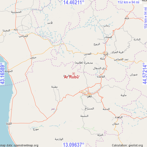
Ar Rubū‘ GPS coordinates[2]
13° 46' 48.864" North, 43° 52' 8.436" East
| Map corner | latitude | longitude |
|---|---|---|
| Upper-left | 14.46211°, | 43.16589° |
| Center: | 13.78024°, | 43.86901° |
| Lower-right: | 13.09637°, | 44.57214° |
| Map W x H: | 151.9×151.9 km | = 94.4×94.4mi |
| max Lat: | 17.76999° ⇑83.8% North |
| Ar Rubū‘: | 13.78024° |
| min Lat: | ⇓16.2% South 12.18576° |
| min Long | Ar Rubū‘ | max Long |
| 42.67107° | 43.86901° | 54.01895° |
| W 29.5%⇐ | ⇒70.5% E |
Elevation
Elevation of Ar Rubū‘ is 1358 m = 4455 ft, and this is 53.2 m = 175 ft above average elevation for this country.
| Max E: |
2791 m = 9157 ft | 46.8% |
| Ar Rubū‘ | 1358 m 4455 ft | |
| Avg. | 1304.8 m = 4281 ft | |
Min E: |
4 m = 13 ft | 53.2% |
See also: Yemen elevation on elevation.city.
Geographical zone
Ar Rubū‘ is located in North Torrid zone (between Equator and Tropic of Cancer). Distance of this Northern Tropic circle is 1073.7 km =667.2 mi to North.| Distance of | km | miles | from Ar Rubū‘ |
|---|---|---|---|
| North Pole | 8474.8 | 5266 | to North |
| Arctic Circle | 5869 | 3646.8 | to North |
| Tropic Cancer | 1073.7 | 667.2 | to North |
| Equator | 1532.2 | 952.1 | to South |


Nearby cities:
15 places around Ar Rubū‘: (largest is in red/bold)
• Al Masālīyah
30.8 km =19.1 mi,  153°
153°
• Al ‘Udayn
25.1 km =15.6 mi,  33°
33°
• Ar Ramādī
21.6 km =13.4 mi,  335°
335°
• Ar Rawnah
7.6 km =4.7 mi,  249°
249°
• As Sayyānī
33.6 km =20.9 mi,  78°
78°
• Dhī as Sufāl
27.2 km =16.9 mi, 77°
• Dār an Nāşir
29.4 km =18.3 mi, 147°
• Jiblah
33.8 km =21 mi,  62°
62°
• Maqbanah
23.5 km =14.6 mi,  236°
236°
• Markaz Mudhaykirah
16.2 km =10.1 mi,  41°
41°
• Qaryat Al kudshi al Ra'inah
10 km =6.2 mi,  178°
178°
• Ta‘izz
27.7 km =17.2 mi,  143°
143°
• Village of ALAMRAH
15.6 km =9.7 mi, 254°
• Yufrus
37.1 km =23.1 mi,  166°
166°
• Ḩazm al ‘Udayn
31.2 km =19.4 mi, 28°
Sources, notices
• [Note1] Compared only with cities in Yemen existing in our database
• [Src1] Map data: © OpenStreetMap contributors (CC-BY-SA)
• [Src2] Other city data from geonames.org with taken over terms of usage.
• [Src3] Geographical zone / Annual Mean Temperature by Robert A. Rohde @ Wikipedia
