Al Miftāḩ geodata
Al Miftāḩ (Ḩajjah) is a seat of a second-order administrative division; located in Yemen in Asia/Aden (GMT+3) time zone. In our database, there are 51 cities with bigger population. Compared to other cities in Yemen, 81.2% of cities are located further ↓South; 86.4% of cities are located further →East and 71.8% of cities have lower elevation than Al Miftāḩ. Note1


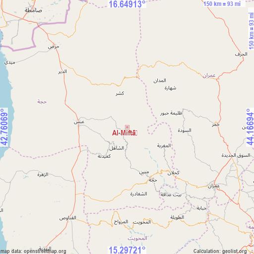
Al Miftāḩ GPS coordinates[2]
15° 58' 27.516" North, 43° 27' 49.716" East
| Map corner | latitude | longitude |
|---|---|---|
| Upper-left | 16.64913°, | 42.76069° |
| Center: | 15.97431°, | 43.46381° |
| Lower-right: | 15.29721°, | 44.16694° |
| Map W x H: | 150.3×150.3 km | = 93.4×93.4mi |
| max Lat: | 17.76999° ⇑18.8% North |
| Al Miftāḩ: | 15.97431° |
| min Lat: | ⇓81.2% South 12.18576° |
| min Long | Al Miftāḩ | max Long |
| 42.67107° | 43.46381° | 54.01895° |
| W 13.6%⇐ | ⇒86.4% E |
Elevation
Elevation of Al Miftāḩ is 1976 m = 6483 ft, and this is 671.2 m = 2202 ft above average elevation for this country.
| Max E: |
2791 m = 9157 ft | 28.2% |
| Al Miftāḩ | 1976 m 6483 ft | |
| Avg. | 1304.8 m = 4281 ft | |
Min E: |
4 m = 13 ft | 71.8% |
See also: Yemen elevation on elevation.city.
Geographical zone
Al Miftāḩ is located in North Torrid zone (between Equator and Tropic of Cancer). Distance of this Northern Tropic circle is 829.7 km =515.6 mi to North.| Distance of | km | miles | from Al Miftāḩ |
|---|---|---|---|
| North Pole | 8230.9 | 5114.4 | to North |
| Arctic Circle | 5625 | 3495.2 | to North |
| Tropic Cancer | 829.7 | 515.6 | to North |
| Equator | 1776.2 | 1103.7 | to South |


Nearby cities:
15 places around Al Miftāḩ: (largest is in red/bold)
• Abs
28.7 km =17.8 mi,  276°
276°
• Al Jamīmah
15 km =9.3 mi,  71°
71°
• Al Madān
33.8 km =21 mi,  34°
34°
• Al Maghrabah
24.2 km =15 mi,  116°
116°
• Al Maḩābishah
4.2 km =2.6 mi,  225°
225°
• Ash Shāhil
13.5 km =8.4 mi,  207°
207°
• Aslam
17.4 km =10.8 mi,  303°
303°
• Khayrān
10.5 km =6.5 mi, 300°
• Kushar
20.6 km =12.8 mi,  347°
347°
• Ku‘aydinah
21.8 km =13.5 mi,  218°
218°
• Mabyan
28.1 km =17.5 mi,  159°
159°
• Sūq Shamar
14.3 km =8.9 mi, 225°
• Waḑarah
29.4 km =18.3 mi,  175°
175°
• Şuwayr
27.9 km =17.3 mi, 34°
• Ḩabūr
27.4 km =17 mi, 71°
Sources, notices
• [Note1] Compared only with cities in Yemen existing in our database
• [Src1] Map data: © OpenStreetMap contributors (CC-BY-SA)
• [Src2] Other city data from geonames.org with taken over terms of usage.
• [Src3] Geographical zone / Annual Mean Temperature by Robert A. Rohde @ Wikipedia
