Al Jamīmah geodata
Al Jamīmah (Ḩajjah) is a seat of a second-order administrative division; located in Yemen in Asia/Aden (GMT+3) time zone. In our database, there are 51 cities with bigger population. Compared to other cities in Yemen, 82.5% of cities are located further ↓South; 80.5% of cities are located further →East and 58.8% of cities have lower elevation than Al Jamīmah. Note1


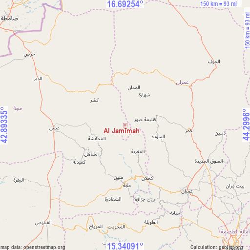
Al Jamīmah GPS coordinates[2]
16° 1' 4.332" North, 43° 35' 47.292" East
| Map corner | latitude | longitude |
|---|---|---|
| Upper-left | 16.69254°, | 42.89335° |
| Center: | 16.01787°, | 43.59647° |
| Lower-right: | 15.34091°, | 44.2996° |
| Map W x H: | 150.3×150.3 km | = 93.4×93.4mi |
| max Lat: | 17.76999° ⇑17.5% North |
| Al Jamīmah: | 16.01787° |
| min Lat: | ⇓82.5% South 12.18576° |
| min Long | Al Jamīmah | max Long |
| 42.67107° | 43.59647° | 54.01895° |
| W 19.5%⇐ | ⇒80.5% E |
Elevation
Elevation of Al Jamīmah is 1547 m = 5075 ft, and this is 242.2 m = 795 ft above average elevation for this country.
| Max E: |
2791 m = 9157 ft | 41.2% |
| Al Jamīmah | 1547 m 5075 ft | |
| Avg. | 1304.8 m = 4281 ft | |
Min E: |
4 m = 13 ft | 58.8% |
See also: Yemen elevation on elevation.city.
Geographical zone
Al Jamīmah is located in North Torrid zone (between Equator and Tropic of Cancer). Distance of this Northern Tropic circle is 824.9 km =512.6 mi to North.| Distance of | km | miles | from Al Jamīmah |
|---|---|---|---|
| North Pole | 8226 | 5111.4 | to North |
| Arctic Circle | 5620.2 | 3492.2 | to North |
| Tropic Cancer | 824.9 | 512.6 | to North |
| Equator | 1781 | 1106.7 | to South |


Nearby cities:
15 places around Al Jamīmah: (largest is in red/bold)
• Al Madān
23.5 km =14.6 mi,  12°
12°
• Al Maghrabah
17.3 km =10.7 mi,  154°
154°
• Al Maḩābishah
18.9 km =11.7 mi,  245°
245°
• Al Miftāḩ
15 km =9.3 mi, 251°
• As Sūdah
20.8 km =12.9 mi,  108°
108°
• Ash Shāhil
26.5 km =16.5 mi,  230°
230°
• Aslam
29.1 km =18.1 mi,  279°
279°
• Khayrān
23.3 km =14.5 mi,  271°
271°
• Kushar
24.2 km =15 mi,  309°
309°
• Kuḩlān ‘Affār
34.3 km =21.3 mi,  157°
157°
• Mabyan
31.4 km =19.5 mi,  187°
187°
• Shahārat al Ghīs
21.7 km =13.5 mi,  31°
31°
• Sūq Shamar
28.5 km =17.7 mi,  238°
238°
• Şuwayr
18.3 km =11.4 mi,  4°
4°
• Ḩabūr
12.4 km =7.7 mi,  72°
72°
Sources, notices
• [Note1] Compared only with cities in Yemen existing in our database
• [Src1] Map data: © OpenStreetMap contributors (CC-BY-SA)
• [Src2] Other city data from geonames.org with taken over terms of usage.
• [Src3] Geographical zone / Annual Mean Temperature by Robert A. Rohde @ Wikipedia
