Al Maḩābishah geodata
Al Maḩābishah (Ḩajjah) is a seat of a second-order administrative division; located in Yemen in Asia/Aden (GMT+3) time zone. In our database, there are 51 cities with bigger population. Compared to other cities in Yemen, 80.5% of cities are located further ↓South; 87% of cities are located further →East and 59.7% of cities have lower elevation than Al Maḩābishah. Note1


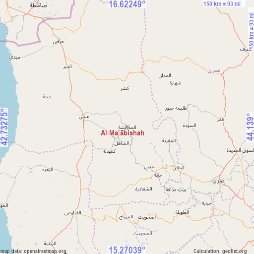
Al Maḩābishah GPS coordinates[2]
15° 56' 51.288" North, 43° 26' 9.132" East
| Map corner | latitude | longitude |
|---|---|---|
| Upper-left | 16.62249°, | 42.73275° |
| Center: | 15.94758°, | 43.43587° |
| Lower-right: | 15.27039°, | 44.139° |
| Map W x H: | 150.3×150.3 km | = 93.4×93.4mi |
| max Lat: | 17.76999° ⇑19.5% North |
| Al Maḩābishah: | 15.94758° |
| min Lat: | ⇓80.5% South 12.18576° |
| min Long | Al Maḩābisha | max Long |
| 42.67107° | 43.43587° | 54.01895° |
| W 13%⇐ | ⇒87% E |
Elevation
Elevation of Al Maḩābishah is 1570 m = 5151 ft, and this is 265.2 m = 870 ft above average elevation for this country.
| Max E: |
2791 m = 9157 ft | 40.3% |
| Al Maḩābishah | 1570 m 5151 ft | |
| Avg. | 1304.8 m = 4281 ft | |
Min E: |
4 m = 13 ft | 59.7% |
See also: Yemen elevation on elevation.city.
Geographical zone
Al Maḩābishah is located in North Torrid zone (between Equator and Tropic of Cancer). Distance of this Northern Tropic circle is 832.7 km =517.4 mi to North.| Distance of | km | miles | from Al Maḩābishah |
|---|---|---|---|
| North Pole | 8233.9 | 5116.3 | to North |
| Arctic Circle | 5628 | 3497.1 | to North |
| Tropic Cancer | 832.7 | 517.4 | to North |
| Equator | 1773.2 | 1101.8 | to South |


Nearby cities:
15 places around Al Maḩābishah: (largest is in red/bold)
• Abs
26.2 km =16.3 mi,  283°
283°
• Al Jamīmah
18.9 km =11.7 mi,  65°
65°
• Al Maghrabah
25.9 km =16.1 mi,  107°
107°
• Al Miftāḩ
4.2 km =2.6 mi,  45°
45°
• Ash Shāhil
9.6 km =6 mi,  200°
200°
• Aslam
17 km =10.6 mi,  317°
317°
• Khayrān
10.3 km =6.4 mi, 323°
• Kushar
23.1 km =14.4 mi,  356°
356°
• Ku‘aydinah
17.6 km =10.9 mi,  216°
216°
• Mabyan
26.7 km =16.6 mi,  150°
150°
• Sūq Shamar
10 km =6.2 mi,  226°
226°
• Waḑarah
26.8 km =16.7 mi,  169°
169°
• Şuwayr
32 km =19.9 mi,  35°
35°
• Ḩabūr
31.2 km =19.4 mi, 68°
• Ḩajjah
33.5 km =20.8 mi, 147°
Sources, notices
• [Note1] Compared only with cities in Yemen existing in our database
• [Src1] Map data: © OpenStreetMap contributors (CC-BY-SA)
• [Src2] Other city data from geonames.org with taken over terms of usage.
• [Src3] Geographical zone / Annual Mean Temperature by Robert A. Rohde @ Wikipedia
