Delmas geodata
Delmas (Mpumalanga) is a seat of a third-order administrative division; located in South Africa in Africa/Johannesburg (GMT+2) time zone. With population of 92,046 people, there are 58 cities with bigger population in this country. Compared to other cities in South Africa, 80.5% of cities are located further ↓South; 66.4% of cities are located further ←West and 85.5% of cities have lower elevation than Delmas. Note1
Administrative division(s):
- Level 1: Mpumalanga
- Level 2: Nkangala District Municipality
- Level 3: Victor Khanye


Delmas GPS coordinates[2]
26° 8' 47.76" South, 28° 40' 59.592" East
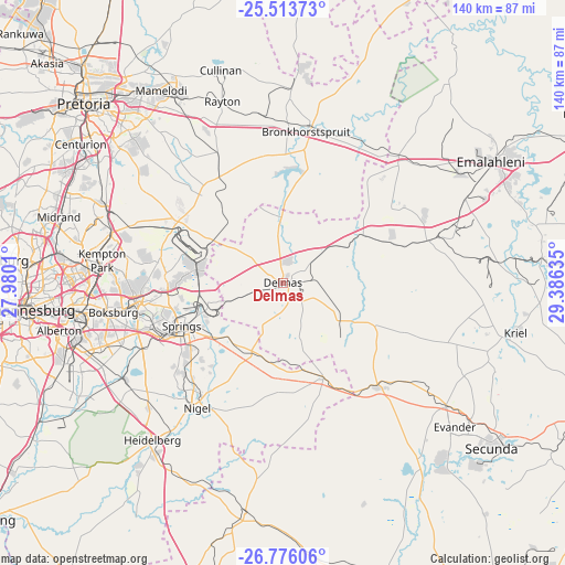
| Map corner | latitude | longitude |
|---|---|---|
| Upper-left | -25.51373°, | 27.9801° |
| Center: | -26.1466°, | 28.68322° |
| Lower-right: | -26.77606°, | 29.38635° |
| Map W x H: | 140.4×140.4 km | = 87.2×87.2mi |
| max Lat: | -22.34881° ⇑19.5% North |
| Delmas: | -26.1466° |
| min Lat: | ⇓80.5% South -34.66739° |
| min Long | Delmas | max Long |
| 16.8697° | 28.68322° | 32.26762° |
| W 66.4%⇐ | ⇒33.6% E |
Elevation
Elevation of Delmas is 1558 m = 5112 ft, and this is 588.4 m = 1930 ft above average elevation for this country.
| Max E: |
1873 m = 6145 ft | 14.5% |
| Delmas | 1558 m 5112 ft | |
| Avg. | 969.6 m = 3181 ft | |
Min E: |
7 m = 23 ft | 85.5% |
See also: Delmas elevation on elevation.city.
Geographical zone
Delmas is located in South temperate zone (between Tropic of Capricorn and the Antarctic Circle). Distance of this Southern Tropic circle is 301.3 km =187.2 mi to North.| Distance of | km | miles | from Delmas |
|---|---|---|---|
| Equator | 2907.2 | 1806.4 | to North |
| Tropic Capricorn | 301.3 | 187.2 | to North |
| Antarctic Circle | 4493.9 | 2792.4 | to South |
| South Pole | 7099.8 | 4411.6 | to South |


Nearby cities:
15 places around Delmas: (largest is in red/bold)
• Benoni
36.5 km =22.7 mi,  262°
262°
• Boksburg
42.9 km =26.7 mi, 260°
• Brakpan
32.9 km =20.4 mi,  252°
252°
• Bronkhorstspruit
37.9 km =23.5 mi,  8°
8°
• Eastleigh
52.7 km =32.7 mi,  272°
272°
• Eden Glen
51.4 km =31.9 mi, 271°
• Eden Glen Ext 60
51.8 km =32.2 mi, 272°
• Edenvale
53 km =32.9 mi, 270°
• Ekangala
50.5 km =31.4 mi, 7°
• Germiston
51.5 km =32 mi, 259°
• Heidelberg
51.3 km =31.9 mi,  219°
219°
• Modderfontein
52.1 km =32.4 mi,  277°
277°
• Nigel
37.7 km =23.4 mi,  212°
212°
• Springs
30.5 km =19 mi, 247°
• Tembisa
48.5 km =30.1 mi,  290°
290°
Sources, notices
• [Note1] Compared only with cities in South Africa existing in our database
• [Src1] Map data: © OpenStreetMap contributors (CC-BY-SA)
• [Src2] Other city data from geonames.org with taken over terms of usage.
• [Src3] Geographical zone / Annual Mean Temperature by Robert A. Rohde @ Wikipedia
