Ekangala geodata
Ekangala (Gauteng) is a populated place; located in South Africa in Africa/Johannesburg (GMT+2) time zone. With population of 37,650 people, there are 108 cities with bigger population in this country. Compared to other cities in South Africa, 87.3% of cities are located further ↓South; 67% of cities are located further ←West and 81.1% of cities have lower elevation than Ekangala. Note1
Administrative division(s):
- Level 1: Gauteng
- Level 2: City of Tshwane Metropolitan Municipality
- Level 3: City of Tshwane


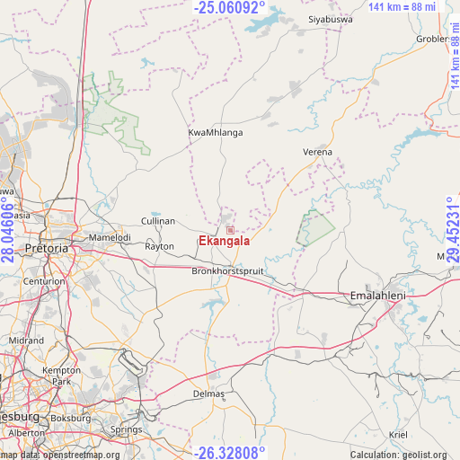
Ekangala GPS coordinates[2]
25° 41' 46.284" South, 28° 44' 57.048" East
| Map corner | latitude | longitude |
|---|---|---|
| Upper-left | -25.06092°, | 28.04606° |
| Center: | -25.69619°, | 28.74918° |
| Lower-right: | -26.32808°, | 29.45231° |
| Map W x H: | 140.9×140.9 km | = 87.6×87.6mi |
| max Lat: | -22.34881° ⇑12.7% North |
| Ekangala: | -25.69619° |
| min Lat: | ⇓87.3% South -34.66739° |
| min Long | Ekangala | max Long |
| 16.8697° | 28.74918° | 32.26762° |
| W 67%⇐ | ⇒33% E |
Elevation
Elevation of Ekangala is 1504 m = 4934 ft, and this is 534.4 m = 1753 ft above average elevation for this country.
| Max E: |
1873 m = 6145 ft | 18.9% |
| Ekangala | 1504 m 4934 ft | |
| Avg. | 969.6 m = 3181 ft | |
Min E: |
7 m = 23 ft | 81.1% |
See also: South Africa elevation on elevation.city.
Geographical zone
Ekangala is located in South temperate zone (between Tropic of Capricorn and the Antarctic Circle). Distance of this Southern Tropic circle is 251.2 km =156.1 mi to North.| Distance of | km | miles | from Ekangala |
|---|---|---|---|
| Equator | 2857.1 | 1775.3 | to North |
| Tropic Capricorn | 251.2 | 156.1 | to North |
| Antarctic Circle | 4544 | 2823.5 | to South |
| South Pole | 7149.9 | 4442.7 | to South |


Nearby cities:
15 places around Ekangala: (largest is in red/bold)
• Benoni
69.5 km =43.2 mi,  218°
218°
• Brakpan
71.1 km =44.2 mi,  212°
212°
• Bronkhorstspruit
12.7 km =7.9 mi,  183°
183°
• Centurion
59.2 km =36.8 mi,  252°
252°
• Cullinan
22.8 km =14.2 mi,  277°
277°
• Delmas
50.5 km =31.4 mi,  187°
187°
• Mabopane
68.7 km =42.7 mi,  288°
288°
• Middelburg
72.2 km =44.9 mi,  96°
96°
• Midrand
70.2 km =43.6 mi,  242°
242°
• Midstream
60.4 km =37.5 mi, 245°
• Pretoria
56.5 km =35.1 mi,  264°
264°
• Siyabuswa
71.3 km =44.3 mi,  24°
24°
• Springs
70.8 km =44 mi, 209°
• Tembisa
62 km =38.5 mi, 237°
• Witbank
52.2 km =32.4 mi,  111°
111°
Sources, notices
• [Note1] Compared only with cities in South Africa existing in our database
• [Src1] Map data: © OpenStreetMap contributors (CC-BY-SA)
• [Src2] Other city data from geonames.org with taken over terms of usage.
• [Src3] Geographical zone / Annual Mean Temperature by Robert A. Rohde @ Wikipedia
