Creighton geodata
Creighton (KwaZulu-Natal) is a seat of a third-order administrative division; located in South Africa in Africa/Johannesburg (GMT+2) time zone. In our database, there are 257 cities with bigger population. Compared to other cities in South Africa, 65.5% of cities are located further ↑North; 77% of cities are located further ←West and 56.3% of cities have higher elevation than Creighton. Note1
Administrative division(s):
- Level 1: KwaZulu-Natal
- Level 2: Sisonke District Municipality
- Level 3: Ingwe


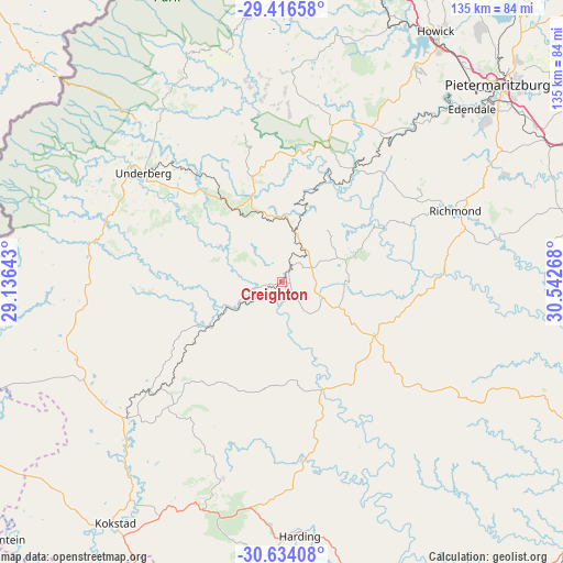
Creighton GPS coordinates[2]
30° 1' 37.92" South, 29° 50' 22.38" East
| Map corner | latitude | longitude |
|---|---|---|
| Upper-left | -29.41658°, | 29.13643° |
| Center: | -30.0272°, | 29.83955° |
| Lower-right: | -30.63408°, | 30.54268° |
| Map W x H: | 135.4×135.4 km | = 84.1×84.1mi |
| max Lat: | -22.34881° ⇑65.5% North |
| Creighton: | -30.0272° |
| min Lat: | ⇓34.5% South -34.66739° |
| min Long | Creighton | max Long |
| 16.8697° | 29.83955° | 32.26762° |
| W 77%⇐ | ⇒23% E |
Elevation
Elevation of Creighton is 1006 m = 3301 ft, and this is 36.4 m = 119 ft above average elevation for this country.
| Max E: |
1873 m = 6145 ft | 56.3% |
| Creighton | 1006 m 3301 ft | |
| Avg. | 969.6 m = 3181 ft | |
Min E: |
7 m = 23 ft | 43.7% |
See also: South Africa elevation on elevation.city.
Geographical zone
Creighton is located in South temperate zone (between Tropic of Capricorn and the Antarctic Circle). Distance of this Southern Tropic circle is 732.8 km =455.3 mi to North.| Distance of | km | miles | from Creighton |
|---|---|---|---|
| Equator | 3338.7 | 2074.6 | to North |
| Tropic Capricorn | 732.8 | 455.3 | to North |
| Antarctic Circle | 4062.5 | 2524.3 | to South |
| South Pole | 6668.4 | 4143.6 | to South |


Nearby cities:
15 places around Creighton: (largest is in red/bold)
• Bizana
92.5 km =57.5 mi,  179°
179°
• Camperdown
75.5 km =46.9 mi,  63°
63°
• Harding
61.2 km =38 mi, 176°
• Himeville
44.3 km =27.5 mi,  314°
314°
• Howick
71.8 km =44.6 mi,  31°
31°
• Impendle
47.5 km =29.5 mi,  3°
3°
• Ixopo
27.1 km =16.8 mi,  120°
120°
• Izingolweni
88.4 km =54.9 mi,  162°
162°
• Kokstad
70.2 km =43.6 mi,  214°
214°
• Mooirivier
92.3 km =57.4 mi,  9°
9°
• Mpophomeni
61 km =37.9 mi, 33°
• Mpumalanga
80.4 km =50 mi,  72°
72°
• Pietermaritzburg
70.2 km =43.6 mi,  49°
49°
• Richmond
45.1 km =28 mi, 67°
• Scottburgh
92.5 km =57.5 mi,  108°
108°
Sources, notices
• [Note1] Compared only with cities in South Africa existing in our database
• [Src1] Map data: © OpenStreetMap contributors (CC-BY-SA)
• [Src2] Other city data from geonames.org with taken over terms of usage.
• [Src3] Geographical zone / Annual Mean Temperature by Robert A. Rohde @ Wikipedia
