Scottburgh geodata
Scottburgh (KwaZulu-Natal) is a seat of a third-order administrative division; located in South Africa in Africa/Johannesburg (GMT+2) time zone. With population of 23,949 people, there are 138 cities with bigger population in this country. Compared to other cities in South Africa, 67% of cities are located further ↑North; 89.7% of cities are located further ←West and 93.2% of cities have higher elevation than Scottburgh. Note1
Administrative division(s):
- Level 1: KwaZulu-Natal
- Level 2: Ugu District Municipality
- Level 3: Umdoni


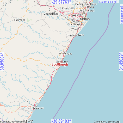
Scottburgh GPS coordinates[2]
30° 17' 11.976" South, 30° 45' 11.376" East
| Map corner | latitude | longitude |
|---|---|---|
| Upper-left | -29.67763°, | 30.05004° |
| Center: | -30.28666°, | 30.75316° |
| Lower-right: | -30.89193°, | 31.45629° |
| Map W x H: | 135×135 km | = 83.9×83.9mi |
| max Lat: | -22.34881° ⇑67% North |
| Scottburgh: | -30.28666° |
| min Lat: | ⇓33% South -34.66739° |
| min Long | Scottburgh | max Long |
| 16.8697° | 30.75316° | 32.26762° |
| W 89.7%⇐ | ⇒10.3% E |
Elevation
Elevation of Scottburgh is 48 m = 157 ft, and this is 921.6 m = 3024 ft below average elevation for this country.
| Max E: |
1873 m = 6145 ft | 93.2% |
| Avg. | 969.6 m = 3181 ft | |
| Scottburgh | 48 m = 157 ft | |
Min E: |
7 m = 23 ft | 6.8% |
See also: South Africa elevation on elevation.city.
Geographical zone
Scottburgh is located in South temperate zone (between Tropic of Capricorn and the Antarctic Circle). Distance of this Southern Tropic circle is 761.6 km =473.2 mi to North.| Distance of | km | miles | from Scottburgh |
|---|---|---|---|
| Equator | 3367.6 | 2092.5 | to North |
| Tropic Capricorn | 761.6 | 473.2 | to North |
| Antarctic Circle | 4033.6 | 2506.4 | to South |
| South Pole | 6639.5 | 4125.6 | to South |


Nearby cities:
15 places around Scottburgh: (largest is in red/bold)
• Berea
53.6 km =33.3 mi,  25°
25°
• Camperdown
65.3 km =40.6 mi,  341°
341°
• Creighton
92.5 km =57.5 mi,  288°
288°
• Durban
54.6 km =33.9 mi, 29°
• Harding
89.3 km =55.5 mi,  248°
248°
• Ixopo
66.1 km =41.1 mi,  283°
283°
• Izingolweni
81.9 km =50.9 mi,  227°
227°
• Margate
73.9 km =45.9 mi,  209°
209°
• Mpumalanga
53.9 km =33.5 mi,  347°
347°
• Ndwedwe
87.2 km =54.2 mi,  11°
11°
• Pietermaritzburg
82.2 km =51.1 mi, 335°
• Port Shepstone
58.1 km =36.1 mi, 209°
• Richmond
65.3 km =40.6 mi,  314°
314°
• Tongaat Beach
84.1 km =52.3 mi, 27°
• eMkhomazi
9.9 km =6.2 mi, 25°
Sources, notices
• [Note1] Compared only with cities in South Africa existing in our database
• [Src1] Map data: © OpenStreetMap contributors (CC-BY-SA)
• [Src2] Other city data from geonames.org with taken over terms of usage.
• [Src3] Geographical zone / Annual Mean Temperature by Robert A. Rohde @ Wikipedia
