Richmond geodata
Richmond (KwaZulu-Natal) is a seat of a third-order administrative division; located in South Africa in Africa/Johannesburg (GMT+2) time zone. With population of 32,445 people, there are 118 cities with bigger population in this country. Compared to other cities in South Africa, 65.2% of cities are located further ↑North; 84.7% of cities are located further ←West and 62.5% of cities have higher elevation than Richmond. Note1
Administrative division(s):
- Level 1: KwaZulu-Natal
- Level 2: uMgungundlovu District Municipality
- Level 3: Richmond


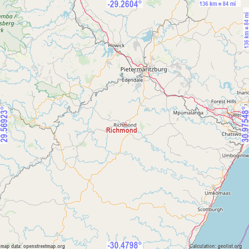
Richmond GPS coordinates[2]
29° 52' 19.056" South, 30° 16' 20.46" East
| Map corner | latitude | longitude |
|---|---|---|
| Upper-left | -29.2604°, | 29.56923° |
| Center: | -29.87196°, | 30.27235° |
| Lower-right: | -30.4798°, | 30.97548° |
| Map W x H: | 135.6×135.6 km | = 84.3×84.3mi |
| max Lat: | -22.34881° ⇑65.2% North |
| Richmond: | -29.87196° |
| min Lat: | ⇓34.8% South -34.66739° |
| min Long | Richmond | max Long |
| 16.8697° | 30.27235° | 32.26762° |
| W 84.7%⇐ | ⇒15.3% E |
Elevation
Elevation of Richmond is 883 m = 2897 ft, and this is 86.6 m = 284 ft below average elevation for this country.
| Max E: |
1873 m = 6145 ft | 62.5% |
| Avg. | 969.6 m = 3181 ft | |
| Richmond | 883 m = 2897 ft | |
Min E: |
7 m = 23 ft | 37.5% |
See also: South Africa elevation on elevation.city.
Geographical zone
Richmond is located in South temperate zone (between Tropic of Capricorn and the Antarctic Circle). Distance of this Southern Tropic circle is 715.5 km =444.6 mi to North.| Distance of | km | miles | from Richmond |
|---|---|---|---|
| Equator | 3321.5 | 2063.9 | to North |
| Tropic Capricorn | 715.5 | 444.6 | to North |
| Antarctic Circle | 4079.7 | 2535 | to South |
| South Pole | 6685.6 | 4154.2 | to South |


Nearby cities:
15 places around Richmond: (largest is in red/bold)
• Berea
69.6 km =43.2 mi,  88°
88°
• Camperdown
30.6 km =19 mi,  58°
58°
• Creighton
45.1 km =28 mi,  247°
247°
• Durban
73 km =45.4 mi, 88°
• Himeville
74.5 km =46.3 mi,  280°
280°
• Howick
44 km =27.3 mi,  354°
354°
• Impendle
49.5 km =30.8 mi,  307°
307°
• Ixopo
35.9 km =22.3 mi,  210°
210°
• Mpophomeni
34.8 km =21.6 mi, 346°
• Mpumalanga
35.7 km =22.2 mi,  79°
79°
• Ndwedwe
74.5 km =46.3 mi, 58°
• Pietermaritzburg
30.7 km =19.1 mi,  22°
22°
• Scottburgh
65.3 km =40.6 mi,  134°
134°
• Wartburg
57 km =35.4 mi,  30°
30°
• eMkhomazi
62.8 km =39 mi, 126°
Sources, notices
• [Note1] Compared only with cities in South Africa existing in our database
• [Src1] Map data: © OpenStreetMap contributors (CC-BY-SA)
• [Src2] Other city data from geonames.org with taken over terms of usage.
• [Src3] Geographical zone / Annual Mean Temperature by Robert A. Rohde @ Wikipedia
