Sar Kāṉī geodata
Sar Kāṉī (Kunar) is a seat of a second-order administrative division; located in Afghanistan in Asia/Kabul (GMT+4.5) time zone. In our database, there are 93 cities with bigger population. Compared to other cities in Afghanistan, 53.1% of cities are located further ↓South; 97.1% of cities are located further ←West and 77.2% of cities have higher elevation than Sar Kāṉī. Note1


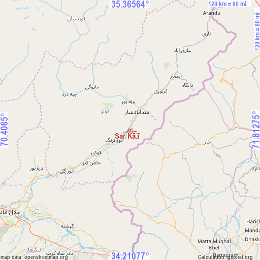
Sar Kāṉī GPS coordinates[2]
34° 47' 24.828" North, 71° 6' 34.632" East
| Map corner | latitude | longitude |
|---|---|---|
| Upper-left | 35.36564°, | 70.4065° |
| Center: | 34.79023°, | 71.10962° |
| Lower-right: | 34.21077°, | 71.81275° |
| Map W x H: | 128.4×128.4 km | = 79.8×79.8mi |
| max Lat: | 38.4435° ⇑46.9% North |
| Sar Kāṉī: | 34.79023° |
| min Lat: | ⇓53.1% South 30.15° |
| min Long | Sar Kāṉī | max Long |
| 61.06667° | 71.10962° | 72.318° |
| W 97.1%⇐ | ⇒2.9% E |
Elevation
Elevation of Sar Kāṉī is 792 m = 2598 ft, and this is 626.4 m = 2055 ft below average elevation for this country.
| Max E: |
3068 m = 10066 ft | 77.2% |
| Avg. | 1418.4 m = 4654 ft | |
| Sar Kāṉī | 792 m = 2598 ft | |
Min E: |
254 m = 833 ft | 22.8% |
See also: Afghanistan elevation on elevation.city.
Geographical zone
Sar Kāṉī is located in North temperate zone (between Tropic of Cancer and the Arctic Circle). Distance of this Northern Tropic circle is 1262.4 km =784.4 mi to South.| Distance of | km | miles | from Sar Kāṉī |
|---|---|---|---|
| North Pole | 6138.8 | 3814.5 | to North |
| Arctic Circle | 3532.9 | 2195.2 | to North |
| Tropic Cancer | 1262.4 | 784.4 | to South |
| Equator | 3868.3 | 2403.6 | to South |


Nearby cities:
15 places around Sar Kāṉī: (largest is in red/bold)
• Asadābād
9.8 km =6.1 mi,  20°
20°
• Dāngām
36.1 km =22.4 mi,  51°
51°
• Gōshtah
57.6 km =35.8 mi,  213°
213°
• Kanḏay
35.2 km =21.9 mi,  301°
301°
• Karbori
24.7 km =15.3 mi,  37°
37°
• Manogay
28.6 km =17.8 mi,  321°
321°
• Narang
6.6 km =4.1 mi,  239°
239°
• Nāṟay
60.8 km =37.8 mi, 38°
• Nūrgal
37.1 km =23.1 mi, 238°
• Qal‘ah-ye Shāhī
49.9 km =31 mi,  251°
251°
• Sangar Sarāy
60.5 km =37.6 mi,  225°
225°
• Sheywah
53.5 km =33.2 mi, 242°
• Tsowkêy
19.9 km =12.4 mi, 236°
• Wuṯahpūr
14.4 km =8.9 mi,  355°
355°
• Āsmār
35.3 km =21.9 mi, 39°
Sources, notices
• [Note1] Compared only with cities in Afghanistan existing in our database
• [Src1] Map data: © OpenStreetMap contributors (CC-BY-SA)
• [Src2] Other city data from geonames.org with taken over terms of usage.
• [Src3] Geographical zone / Annual Mean Temperature by Robert A. Rohde @ Wikipedia
