Wuṯahpūr geodata
Wuṯahpūr (Kunar) is a seat of a second-order administrative division; located in Afghanistan in Asia/Kabul (GMT+4.5) time zone. In our database, there are 93 cities with bigger population. Compared to other cities in Afghanistan, 57.2% of cities are located further ↓South; 96.8% of cities are located further ←West and 73% of cities have higher elevation than Wuṯahpūr. Note1


Wuṯahpūr GPS coordinates[2]
34° 55' 8.904" North, 71° 5' 55.068" East
| Map corner | latitude | longitude |
|---|---|---|
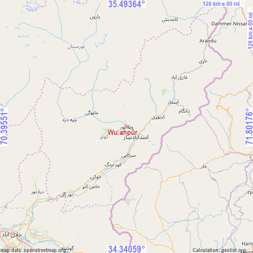
| Upper-left | 35.49364°, | 70.39551° |
| Center: | 34.91914°, | 71.09863° |
| Lower-right: | 34.34059°, | 71.80176° |
| Map W x H: | 128.2×128.2 km | = 79.7×79.7mi |
| max Lat: | 38.4435° ⇑42.8% North |
| Wuṯahpūr: | 34.91914° |
| min Lat: | ⇓57.2% South 30.15° |
| min Long | Wuṯahpūr | max Long |
| 61.06667° | 71.09863° | 72.318° |
| W 96.8%⇐ | ⇒3.2% E |
Elevation
Elevation of Wuṯahpūr is 872 m = 2861 ft, and this is 546.4 m = 1793 ft below average elevation for this country.
| Max E: |
3068 m = 10066 ft | 73% |
| Avg. | 1418.4 m = 4654 ft | |
| Wuṯahpūr | 872 m = 2861 ft | |
Min E: |
254 m = 833 ft | 27% |
See also: Afghanistan elevation on elevation.city.
Geographical zone
Wuṯahpūr is located in North temperate zone (between Tropic of Cancer and the Arctic Circle). Distance of this Northern Tropic circle is 1276.7 km =793.3 mi to South.| Distance of | km | miles | from Wuṯahpūr |
|---|---|---|---|
| North Pole | 6124.4 | 3805.5 | to North |
| Arctic Circle | 3518.5 | 2186.3 | to North |
| Tropic Cancer | 1276.7 | 793.3 | to South |
| Equator | 3882.6 | 2412.5 | to South |


Nearby cities:
15 places around Wuṯahpūr: (largest is in red/bold)
• Asadābād
6.8 km =4.2 mi,  139°
139°
• Dāngām
30.3 km =18.8 mi,  74°
74°
• Kanḏay
29.4 km =18.3 mi,  277°
277°
• Karbori
16.9 km =10.5 mi, 72°
• Manogay
18.7 km =11.6 mi,  295°
295°
• Narang
18.3 km =11.4 mi,  194°
194°
• Nāṟay
51.1 km =31.8 mi,  49°
49°
• Nūrgal
45.7 km =28.4 mi,  221°
221°
• Pārūn
58 km =36 mi,  343°
343°
• Qal‘ah-ye Shāhī
55.2 km =34.3 mi,  237°
237°
• Sar Kāṉī
14.4 km =8.9 mi,  175°
175°
• Sheywah
60.5 km =37.6 mi,  230°
230°
• Tsowkêy
29.7 km =18.5 mi,  211°
211°
• Wuluswālī ‘Alīngār
68.1 km =42.3 mi,  262°
262°
• Āsmār
26.8 km =16.7 mi,  61°
61°
Sources, notices
• [Note1] Compared only with cities in Afghanistan existing in our database
• [Src1] Map data: © OpenStreetMap contributors (CC-BY-SA)
• [Src2] Other city data from geonames.org with taken over terms of usage.
• [Src3] Geographical zone / Annual Mean Temperature by Robert A. Rohde @ Wikipedia
