Tsowkêy geodata
Tsowkêy (Kunar) is a seat of a second-order administrative division; located in Afghanistan in Asia/Kabul (GMT+4.5) time zone. In our database, there are 93 cities with bigger population. Compared to other cities in Afghanistan, 50.8% of cities are located further ↓South; 95.5% of cities are located further ←West and 79.7% of cities have higher elevation than Tsowkêy. Note1


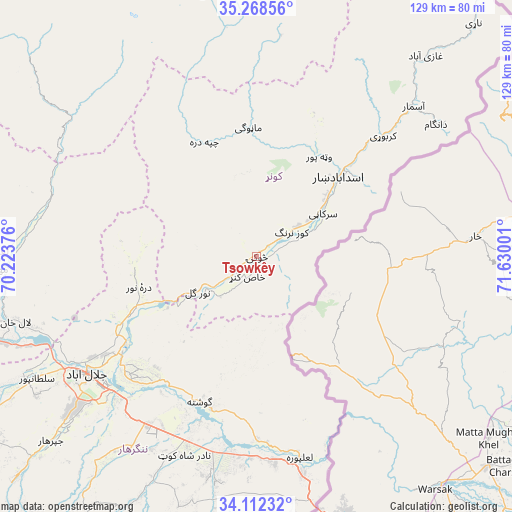
Tsowkêy GPS coordinates[2]
34° 41' 32.856" North, 70° 55' 36.768" East
| Map corner | latitude | longitude |
|---|---|---|
| Upper-left | 35.26856°, | 70.22376° |
| Center: | 34.69246°, | 70.92688° |
| Lower-right: | 34.11232°, | 71.63001° |
| Map W x H: | 128.6×128.6 km | = 79.9×79.9mi |
| max Lat: | 38.4435° ⇑49.2% North |
| Tsowkêy: | 34.69246° |
| min Lat: | ⇓50.8% South 30.15° |
| min Long | Tsowkêy | max Long |
| 61.06667° | 70.92688° | 72.318° |
| W 95.5%⇐ | ⇒4.5% E |
Elevation
Elevation of Tsowkêy is 725 m = 2379 ft, and this is 693.4 m = 2275 ft below average elevation for this country.
| Max E: |
3068 m = 10066 ft | 79.7% |
| Avg. | 1418.4 m = 4654 ft | |
| Tsowkêy | 725 m = 2379 ft | |
Min E: |
254 m = 833 ft | 20.3% |
See also: Afghanistan elevation on elevation.city.
Geographical zone
Tsowkêy is located in North temperate zone (between Tropic of Cancer and the Arctic Circle). Distance of this Northern Tropic circle is 1251.5 km =777.6 mi to South.| Distance of | km | miles | from Tsowkêy |
|---|---|---|---|
| North Pole | 6149.6 | 3821.2 | to North |
| Arctic Circle | 3543.7 | 2202 | to North |
| Tropic Cancer | 1251.5 | 777.6 | to South |
| Equator | 3857.4 | 2396.9 | to South |


Nearby cities:
15 places around Tsowkêy: (largest is in red/bold)
• Asadābād
28.4 km =17.6 mi,  45°
45°
• Bāsawul
49.7 km =30.9 mi,  185°
185°
• Gōshtah
40.1 km =24.9 mi,  202°
202°
• Jalālābād
52.6 km =32.7 mi,  235°
235°
• Kanḏay
32 km =19.9 mi,  335°
335°
• Karbori
44 km =27.3 mi, 46°
• Manogay
33.1 km =20.6 mi,  357°
357°
• Narang
13.3 km =8.3 mi,  55°
55°
• Nūrgal
17.2 km =10.7 mi, 239°
• Qal‘ah-ye Shāhī
31.1 km =19.3 mi,  261°
261°
• Sangar Sarāy
41.2 km =25.6 mi,  219°
219°
• Sar Kāṉī
19.9 km =12.4 mi, 56°
• Sheywah
33.7 km =20.9 mi,  246°
246°
• Wuluswālī ‘Alīngār
54.2 km =33.7 mi,  287°
287°
• Wuṯahpūr
29.7 km =18.5 mi,  31°
31°
Sources, notices
• [Note1] Compared only with cities in Afghanistan existing in our database
• [Src1] Map data: © OpenStreetMap contributors (CC-BY-SA)
• [Src2] Other city data from geonames.org with taken over terms of usage.
• [Src3] Geographical zone / Annual Mean Temperature by Robert A. Rohde @ Wikipedia
