Kaçinar geodata
Kaçinar (Lezhë) is a seat of a third-order administrative division; located in Albania in Europe/Tirane (GMT+2) time zone. In our database, there are 71 cities with bigger population. Compared to other cities in Albania, 86.5% of cities are located further ↓South; 57.5% of cities are located further →East and 62.3% of cities have lower elevation than Kaçinar. Note1


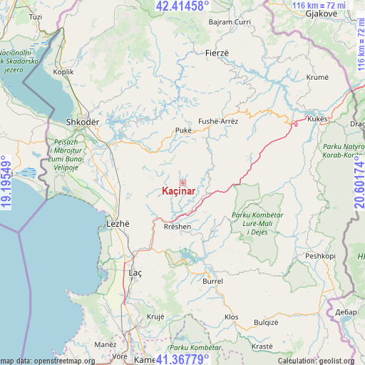
Kaçinar GPS coordinates[2]
41° 53' 35.988" North, 19° 53' 54.996" East
| Map corner | latitude | longitude |
|---|---|---|
| Upper-left | 42.41458°, | 19.19549° |
| Center: | 41.89333°, | 19.89861° |
| Lower-right: | 41.36779°, | 20.60174° |
| Map W x H: | 116.4×116.4 km | = 72.3×72.3mi |
| max Lat: | 42.45139° ⇑13.5% North |
| Kaçinar: | 41.89333° |
| min Lat: | ⇓86.5% South 39.65889° |
| min Long | Kaçinar | max Long |
| 19.40556° | 19.89861° | 20.99° |
| W 42.5%⇐ | ⇒57.5% E |
Elevation
Elevation of Kaçinar is 430 m = 1411 ft, and this is 55.4 m = 182 ft above average elevation for this country.
| Max E: |
1352 m = 4436 ft | 37.7% |
| Kaçinar | 430 m 1411 ft | |
| Avg. | 374.6 m = 1229 ft | |
Min E: |
-2 m = -7 ft | 62.3% |
See also: Albania elevation on elevation.city.
Geographical zone
Kaçinar is located in North temperate zone (between Tropic of Cancer and the Arctic Circle). Distance of this Northern Tropic circle is 2052.2 km =1275.2 mi to South.| Distance of | km | miles | from Kaçinar |
|---|---|---|---|
| North Pole | 5349 | 3323.7 | to North |
| Arctic Circle | 2743.1 | 1704.5 | to North |
| Tropic Cancer | 2052.2 | 1275.2 | to South |
| Equator | 4658.1 | 2894.4 | to South |


Nearby cities:
15 places around Kaçinar: (largest is in red/bold)
• Blinisht
9.1 km =5.7 mi,  112°
112°
• Fushë-Arrëz
21.2 km =13.2 mi,  27°
27°
• Gjegjan
10.5 km =6.5 mi,  62°
62°
• Kallmeti i Madh
18.2 km =11.3 mi,  254°
254°
• Kolç
21.9 km =13.6 mi,  237°
237°
• Kthella e Epërme
16.1 km =10 mi,  124°
124°
• Kurbnesh
19.9 km =12.4 mi,  129°
129°
• Orosh
16.7 km =10.4 mi, 113°
• Pukë
16.8 km =10.4 mi,  0°
0°
• Qelëz
21.8 km =13.5 mi,  359°
359°
• Qerret
18.5 km =11.5 mi,  344°
344°
• Rrapë
17.8 km =11.1 mi,  19°
19°
• Rrëshen
14.1 km =8.8 mi,  187°
187°
• Rubik
16.2 km =10.1 mi,  215°
215°
• Ungrej
8.8 km =5.5 mi,  256°
256°
Sources, notices
• [Note1] Compared only with cities in Albania existing in our database
• [Src1] Map data: © OpenStreetMap contributors (CC-BY-SA)
• [Src2] Other city data from geonames.org with taken over terms of usage.
• [Src3] Geographical zone / Annual Mean Temperature by Robert A. Rohde @ Wikipedia
