Tsaghkaber geodata
Tsaghkaber (Lori) is a populated place; located in Armenia in Asia/Yerevan (GMT+4) time zone. With population of 1,207 people, there are 266 cities with bigger population in this country. Compared to other cities in Armenia, 84.4% of cities are located further ↓South; 84.1% of cities are located further →East and 78.3% of cities have lower elevation than Tsaghkaber. Note1


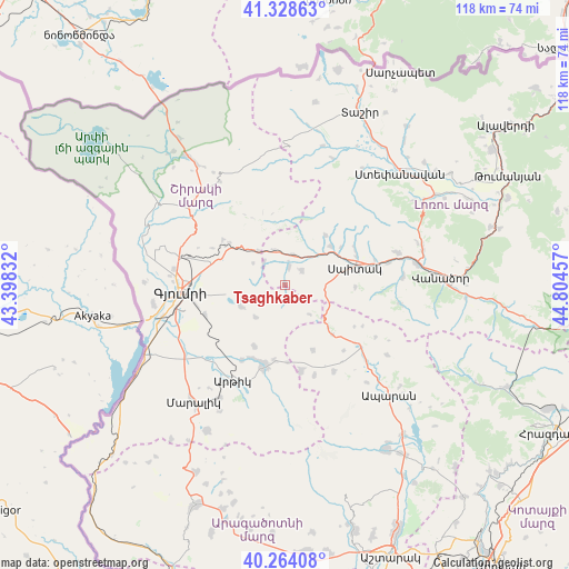
Tsaghkaber GPS coordinates[2]
40° 47' 54.564" North, 44° 6' 5.184" East
| Map corner | latitude | longitude |
|---|---|---|
| Upper-left | 41.32863°, | 43.39832° |
| Center: | 40.79849°, | 44.10144° |
| Lower-right: | 40.26408°, | 44.80457° |
| Map W x H: | 118.4×118.4 km | = 73.6×73.6mi |
| max Lat: | 41.24358° ⇑15.6% North |
| Tsaghkaber: | 40.79849° |
| min Lat: | ⇓84.4% South 38.90292° |
| min Long | Tsaghkaber | max Long |
| 43.74722° | 44.10144° | 46.5446° |
| W 15.9%⇐ | ⇒84.1% E |
Elevation
Elevation of Tsaghkaber is 1762 m = 5781 ft, and this is 460.5 m = 1511 ft above average elevation for this country.
| Max E: |
2169 m = 7116 ft | 21.7% |
| Tsaghkaber | 1762 m 5781 ft | |
| Avg. | 1301.5 m = 4270 ft | |
Min E: |
440 m = 1444 ft | 78.3% |
See also: Armenia elevation on elevation.city.
Geographical zone
Tsaghkaber is located in North temperate zone (between Tropic of Cancer and the Arctic Circle). Distance of this Northern Tropic circle is 1930.4 km =1199.5 mi to South.| Distance of | km | miles | from Tsaghkaber |
|---|---|---|---|
| North Pole | 5470.7 | 3399.3 | to North |
| Arctic Circle | 2864.8 | 1780.1 | to North |
| Tropic Cancer | 1930.4 | 1199.5 | to South |
| Equator | 4536.4 | 2818.8 | to South |


Nearby cities:
15 places around Tsaghkaber: (largest is in red/bold)
• Arevashogh
16.1 km =10 mi,  64°
64°
• Arevshat
16.8 km =10.4 mi,  196°
196°
• Basen
10.2 km =6.3 mi,  243°
243°
• Gogaran
13.3 km =8.3 mi,  38°
38°
• Jrashen
7.2 km =4.5 mi,  97°
97°
• Kamo
13 km =8.1 mi,  283°
283°
• Lerrnants’k’
14.6 km =9.1 mi,  91°
91°
• Lerrnavan
5.1 km =3.2 mi, 103°
• Mets Parni
4.1 km =2.5 mi,  11°
11°
• Sarahart’
12.4 km =7.7 mi,  49°
49°
• Saramej
10.5 km =6.5 mi, 104°
• Shirak
16.3 km =10.1 mi,  286°
286°
• Shirakamut
8.1 km =5 mi,  32°
32°
• Spandaryan
16.9 km =10.5 mi,  205°
205°
• Spitak
14.5 km =9 mi,  74°
74°
Sources, notices
• [Note1] Compared only with cities in Armenia existing in our database
• [Src1] Map data: © OpenStreetMap contributors (CC-BY-SA)
• [Src2] Other city data from geonames.org with taken over terms of usage.
• [Src3] Geographical zone / Annual Mean Temperature by Robert A. Rohde @ Wikipedia
