Basen geodata
Basen (Shirak) is a populated place; located in Armenia in Asia/Yerevan (GMT+4) time zone. With population of 1,499 people, there are 224 cities with bigger population in this country. Compared to other cities in Armenia, 80.9% of cities are located further ↓South; 90.4% of cities are located further →East and 72.3% of cities have lower elevation than Basen. Note1


Basen GPS coordinates[2]
40° 45' 27.612" North, 43° 59' 33.864" East
| Map corner | latitude | longitude |
|---|---|---|
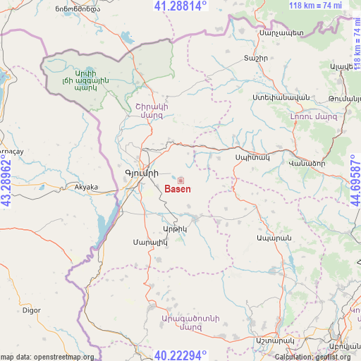
| Upper-left | 41.28814°, | 43.28962° |
| Center: | 40.75767°, | 43.99274° |
| Lower-right: | 40.22294°, | 44.69587° |
| Map W x H: | 118.4×118.4 km | = 73.6×73.6mi |
| max Lat: | 41.24358° ⇑19.1% North |
| Basen: | 40.75767° |
| min Lat: | ⇓80.9% South 38.90292° |
| min Long | Basen | max Long |
| 43.74722° | 43.99274° | 46.5446° |
| W 9.6%⇐ | ⇒90.4% E |
Elevation
Elevation of Basen is 1638 m = 5374 ft, and this is 336.5 m = 1104 ft above average elevation for this country.
| Max E: |
2169 m = 7116 ft | 27.7% |
| Basen | 1638 m 5374 ft | |
| Avg. | 1301.5 m = 4270 ft | |
Min E: |
440 m = 1444 ft | 72.3% |
See also: Armenia elevation on elevation.city.
Geographical zone
Basen is located in North temperate zone (between Tropic of Cancer and the Arctic Circle). Distance of this Northern Tropic circle is 1925.9 km =1196.7 mi to South.| Distance of | km | miles | from Basen |
|---|---|---|---|
| North Pole | 5475.2 | 3402.1 | to North |
| Arctic Circle | 2869.3 | 1782.9 | to North |
| Tropic Cancer | 1925.9 | 1196.7 | to South |
| Equator | 4531.8 | 2815.9 | to South |


Nearby cities:
15 places around Basen: (largest is in red/bold)
• Akhuryan
8.2 km =5.1 mi,  287°
287°
• Anushavan
12 km =7.5 mi,  184°
184°
• Arevik
7.7 km =4.8 mi,  256°
256°
• Arevshat
12.4 km =7.7 mi,  159°
159°
• Gyumri
13.1 km =8.1 mi, 288°
• Horrom
13.9 km =8.6 mi,  218°
218°
• Kamo
8.4 km =5.2 mi,  334°
334°
• Meghrashen
9.9 km =6.2 mi,  196°
196°
• Mets Mant’ash
13.8 km =8.6 mi, 156°
• Mets Parni
13.1 km =8.1 mi,  49°
49°
• P’ok’r Mant’ash
13.8 km =8.6 mi, 160°
• Saratak
14 km =8.7 mi,  226°
226°
• Shirak
11.3 km =7 mi,  324°
324°
• Spandaryan
10.9 km =6.8 mi,  169°
169°
• Tsaghkaber
10.2 km =6.3 mi,  63°
63°
Sources, notices
• [Note1] Compared only with cities in Armenia existing in our database
• [Src1] Map data: © OpenStreetMap contributors (CC-BY-SA)
• [Src2] Other city data from geonames.org with taken over terms of usage.
• [Src3] Geographical zone / Annual Mean Temperature by Robert A. Rohde @ Wikipedia
