Jrashen geodata
Jrashen (Lori) is a populated place; located in Armenia in Asia/Yerevan (GMT+4) time zone. With population of 3,078 people, there are 90 cities with bigger population in this country. Compared to other cities in Armenia, 83.4% of cities are located further ↓South; 80.6% of cities are located further →East and 74.5% of cities have lower elevation than Jrashen. Note1


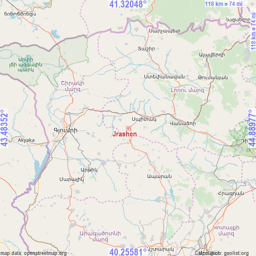
Jrashen GPS coordinates[2]
40° 47' 25.008" North, 44° 11' 11.904" East
| Map corner | latitude | longitude |
|---|---|---|
| Upper-left | 41.32048°, | 43.48352° |
| Center: | 40.79028°, | 44.18664° |
| Lower-right: | 40.25581°, | 44.88977° |
| Map W x H: | 118.4×118.4 km | = 73.6×73.6mi |
| max Lat: | 41.24358° ⇑16.6% North |
| Jrashen: | 40.79028° |
| min Lat: | ⇓83.4% South 38.90292° |
| min Long | Jrashen | max Long |
| 43.74722° | 44.18664° | 46.5446° |
| W 19.4%⇐ | ⇒80.6% E |
Elevation
Elevation of Jrashen is 1676 m = 5499 ft, and this is 374.5 m = 1229 ft above average elevation for this country.
| Max E: |
2169 m = 7116 ft | 25.5% |
| Jrashen | 1676 m 5499 ft | |
| Avg. | 1301.5 m = 4270 ft | |
Min E: |
440 m = 1444 ft | 74.5% |
See also: Armenia elevation on elevation.city.
Geographical zone
Jrashen is located in North temperate zone (between Tropic of Cancer and the Arctic Circle). Distance of this Northern Tropic circle is 1929.5 km =1198.9 mi to South.| Distance of | km | miles | from Jrashen |
|---|---|---|---|
| North Pole | 5471.6 | 3399.9 | to North |
| Arctic Circle | 2865.7 | 1780.7 | to North |
| Tropic Cancer | 1929.5 | 1198.9 | to South |
| Equator | 4535.5 | 2818.2 | to South |


Nearby cities:
15 places around Jrashen: (largest is in red/bold)
• Arevashogh
10.7 km =6.6 mi,  43°
43°
• Arevshat
19.4 km =12.1 mi,  218°
218°
• Basen
16.7 km =10.4 mi,  257°
257°
• Gogaran
11.4 km =7.1 mi,  5°
5°
• Hnaberd
17.5 km =10.9 mi,  192°
192°
• Lerrnants’k’
7.4 km =4.6 mi,  85°
85°
• Lerrnapat
17.6 km =10.9 mi,  80°
80°
• Lerrnavan
2.2 km =1.4 mi, 264°
• Mets Parni
8.1 km =5 mi,  307°
307°
• Sarahart’
9.2 km =5.7 mi, 14°
• Saramej
3.4 km =2.1 mi,  119°
119°
• Shirakamut
8.3 km =5.2 mi,  339°
339°
• Spitak
8.2 km =5.1 mi,  55°
55°
• Tsaghkaber
7.2 km =4.5 mi,  277°
277°
• Tsaghkahovit
17.6 km =10.9 mi,  170°
170°
Sources, notices
• [Note1] Compared only with cities in Armenia existing in our database
• [Src1] Map data: © OpenStreetMap contributors (CC-BY-SA)
• [Src2] Other city data from geonames.org with taken over terms of usage.
• [Src3] Geographical zone / Annual Mean Temperature by Robert A. Rohde @ Wikipedia
