Mets Parni geodata
Mets Parni (Lori) is a populated place; located in Armenia in Asia/Yerevan (GMT+4) time zone. With population of 1,934 people, there are 164 cities with bigger population in this country. Compared to other cities in Armenia, 86.6% of cities are located further ↓South; 83.8% of cities are located further →East and 75.8% of cities have lower elevation than Mets Parni. Note1


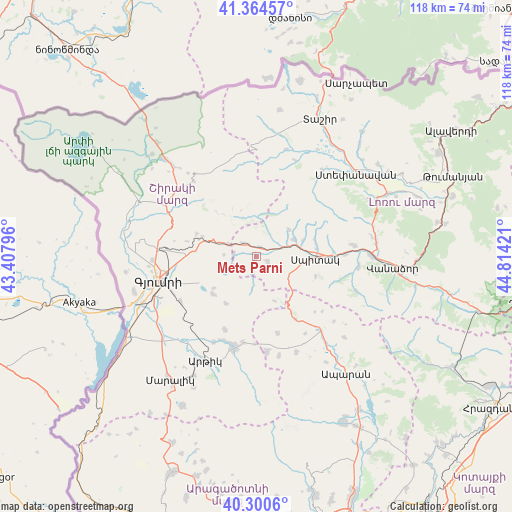
Mets Parni GPS coordinates[2]
40° 50' 4.992" North, 44° 6' 39.888" East
| Map corner | latitude | longitude |
|---|---|---|
| Upper-left | 41.36457°, | 43.40796° |
| Center: | 40.83472°, | 44.11108° |
| Lower-right: | 40.3006°, | 44.81421° |
| Map W x H: | 118.3×118.3 km | = 73.5×73.5mi |
| max Lat: | 41.24358° ⇑13.4% North |
| Mets Parni: | 40.83472° |
| min Lat: | ⇓86.6% South 38.90292° |
| min Long | Mets Parni | max Long |
| 43.74722° | 44.11108° | 46.5446° |
| W 16.2%⇐ | ⇒83.8% E |
Elevation
Elevation of Mets Parni is 1697 m = 5568 ft, and this is 395.5 m = 1298 ft above average elevation for this country.
| Max E: |
2169 m = 7116 ft | 24.2% |
| Mets Parni | 1697 m 5568 ft | |
| Avg. | 1301.5 m = 4270 ft | |
Min E: |
440 m = 1444 ft | 75.8% |
See also: Armenia elevation on elevation.city.
Geographical zone
Mets Parni is located in North temperate zone (between Tropic of Cancer and the Arctic Circle). Distance of this Northern Tropic circle is 1934.5 km =1202 mi to South.| Distance of | km | miles | from Mets Parni |
|---|---|---|---|
| North Pole | 5466.7 | 3396.8 | to North |
| Arctic Circle | 2860.8 | 1777.6 | to North |
| Tropic Cancer | 1934.5 | 1202 | to South |
| Equator | 4540.4 | 2821.3 | to South |


Nearby cities:
15 places around Mets Parni: (largest is in red/bold)
• Akhuryan
18.8 km =11.7 mi,  251°
251°
• Arevashogh
14 km =8.7 mi,  78°
78°
• Arevik
20.2 km =12.6 mi,  239°
239°
• Basen
13.1 km =8.1 mi,  229°
229°
• Gogaran
9.8 km =6.1 mi,  49°
49°
• Jrashen
8.1 km =5 mi,  127°
127°
• Kamo
13.5 km =8.4 mi,  265°
265°
• Lerrnants’k’
14.4 km =8.9 mi,  107°
107°
• Lerrnavan
6.6 km =4.1 mi,  141°
141°
• Sarahart’
9.5 km =5.9 mi,  65°
65°
• Saramej
11.5 km =7.1 mi, 125°
• Shirak
16.4 km =10.2 mi, 272°
• Shirakamut
4.5 km =2.8 mi, 50°
• Spitak
13.1 km =8.1 mi,  91°
91°
• Tsaghkaber
4.1 km =2.5 mi,  191°
191°
Sources, notices
• [Note1] Compared only with cities in Armenia existing in our database
• [Src1] Map data: © OpenStreetMap contributors (CC-BY-SA)
• [Src2] Other city data from geonames.org with taken over terms of usage.
• [Src3] Geographical zone / Annual Mean Temperature by Robert A. Rohde @ Wikipedia
