Lerrnavan geodata
Lerrnavan (Lori) is a populated place; located in Armenia in Asia/Yerevan (GMT+4) time zone. With population of 1,517 people, there are 220 cities with bigger population in this country. Compared to other cities in Armenia, 83.1% of cities are located further ↓South; 82.2% of cities are located further →East and 80.3% of cities have lower elevation than Lerrnavan. Note1


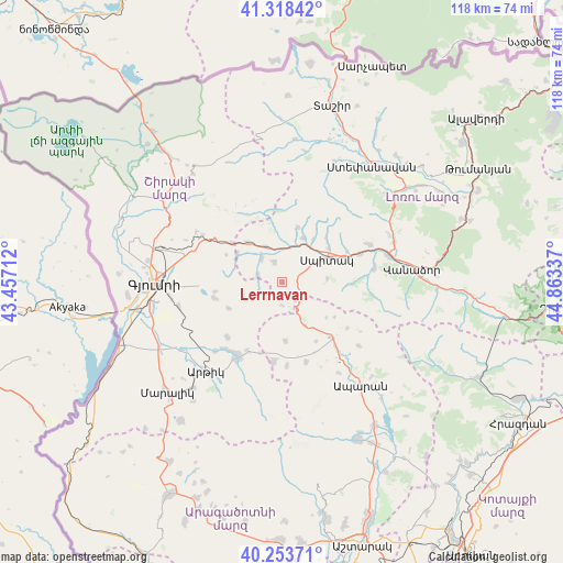
Lerrnavan GPS coordinates[2]
40° 47' 17.52" North, 44° 9' 36.864" East
| Map corner | latitude | longitude |
|---|---|---|
| Upper-left | 41.31842°, | 43.45712° |
| Center: | 40.7882°, | 44.16024° |
| Lower-right: | 40.25371°, | 44.86337° |
| Map W x H: | 118.4×118.4 km | = 73.6×73.6mi |
| max Lat: | 41.24358° ⇑16.9% North |
| Lerrnavan: | 40.7882° |
| min Lat: | ⇓83.1% South 38.90292° |
| min Long | Lerrnavan | max Long |
| 43.74722° | 44.16024° | 46.5446° |
| W 17.8%⇐ | ⇒82.2% E |
Elevation
Elevation of Lerrnavan is 1778 m = 5833 ft, and this is 476.5 m = 1563 ft above average elevation for this country.
| Max E: |
2169 m = 7116 ft | 19.7% |
| Lerrnavan | 1778 m 5833 ft | |
| Avg. | 1301.5 m = 4270 ft | |
Min E: |
440 m = 1444 ft | 80.3% |
See also: Armenia elevation on elevation.city.
Geographical zone
Lerrnavan is located in North temperate zone (between Tropic of Cancer and the Arctic Circle). Distance of this Northern Tropic circle is 1929.3 km =1198.8 mi to South.| Distance of | km | miles | from Lerrnavan |
|---|---|---|---|
| North Pole | 5471.8 | 3400 | to North |
| Arctic Circle | 2866 | 1780.8 | to North |
| Tropic Cancer | 1929.3 | 1198.8 | to South |
| Equator | 4535.2 | 2818 | to South |


Nearby cities:
15 places around Lerrnavan: (largest is in red/bold)
• Arevashogh
12.5 km =7.8 mi,  50°
50°
• Arevshat
17.9 km =11.1 mi,  213°
213°
• Basen
14.5 km =9 mi,  256°
256°
• Gogaran
12.1 km =7.5 mi,  15°
15°
• Hnaberd
16.9 km =10.5 mi,  185°
185°
• Jrashen
2.2 km =1.4 mi,  84°
84°
• Kamo
18.1 km =11.2 mi,  283°
283°
• Lerrnants’k’
9.6 km =6 mi,  85°
85°
• Mets Parni
6.6 km =4.1 mi,  321°
321°
• Sarahart’
10.2 km =6.3 mi,  26°
26°
• Saramej
5.4 km =3.4 mi,  105°
105°
• Shirakamut
8.1 km =5 mi,  355°
355°
• Spitak
10.3 km =6.4 mi,  61°
61°
• Tsaghkaber
5.1 km =3.2 mi, 283°
• Tsaghkahovit
17.9 km =11.1 mi,  162°
162°
Sources, notices
• [Note1] Compared only with cities in Armenia existing in our database
• [Src1] Map data: © OpenStreetMap contributors (CC-BY-SA)
• [Src2] Other city data from geonames.org with taken over terms of usage.
• [Src3] Geographical zone / Annual Mean Temperature by Robert A. Rohde @ Wikipedia
