Spandaryan geodata
Spandaryan (Shirak) is a populated place; located in Armenia in Asia/Yerevan (GMT+4) time zone. With population of 1,226 people, there are 263 cities with bigger population in this country. Compared to other cities in Armenia, 77.4% of cities are located further ↓South; 89.2% of cities are located further →East and 82.8% of cities have lower elevation than Spandaryan. Note1


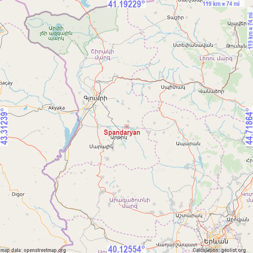
Spandaryan GPS coordinates[2]
40° 39' 39.78" North, 44° 0' 55.836" East
| Map corner | latitude | longitude |
|---|---|---|
| Upper-left | 41.19229°, | 43.31239° |
| Center: | 40.66105°, | 44.01551° |
| Lower-right: | 40.12554°, | 44.71864° |
| Map W x H: | 118.6×118.6 km | = 73.7×73.7mi |
| max Lat: | 41.24358° ⇑22.6% North |
| Spandaryan: | 40.66105° |
| min Lat: | ⇓77.4% South 38.90292° |
| min Long | Spandaryan | max Long |
| 43.74722° | 44.01551° | 46.5446° |
| W 10.8%⇐ | ⇒89.2% E |
Elevation
Elevation of Spandaryan is 1825 m = 5988 ft, and this is 523.5 m = 1718 ft above average elevation for this country.
| Max E: |
2169 m = 7116 ft | 17.2% |
| Spandaryan | 1825 m 5988 ft | |
| Avg. | 1301.5 m = 4270 ft | |
Min E: |
440 m = 1444 ft | 82.8% |
See also: Armenia elevation on elevation.city.
Geographical zone
Spandaryan is located in North temperate zone (between Tropic of Cancer and the Arctic Circle). Distance of this Northern Tropic circle is 1915.2 km =1190 mi to South.| Distance of | km | miles | from Spandaryan |
|---|---|---|---|
| North Pole | 5486 | 3408.8 | to North |
| Arctic Circle | 2880.1 | 1789.6 | to North |
| Tropic Cancer | 1915.2 | 1190 | to South |
| Equator | 4521.1 | 2809.3 | to South |


Nearby cities:
15 places around Spandaryan: (largest is in red/bold)
• Akhuryan
16.4 km =10.2 mi,  323°
323°
• Anushavan
3.2 km =2 mi,  247°
247°
• Arevik
13 km =8.1 mi,  313°
313°
• Arevshat
2.6 km =1.6 mi,  109°
109°
• Basen
10.9 km =6.8 mi,  349°
349°
• Hnaberd
10.9 km =6.8 mi,  104°
104°
• Horrom
10.6 km =6.6 mi,  269°
269°
• Lerrnakert
12.7 km =7.9 mi,  210°
210°
• Maralik
15.4 km =9.6 mi,  231°
231°
• Meghrashen
5 km =3.1 mi,  284°
284°
• Mets Mant’ash
4 km =2.5 mi,  119°
119°
• Pemzashen
10.3 km =6.4 mi,  216°
216°
• P’ok’r Mant’ash
3.5 km =2.2 mi,  131°
131°
• Saratak
12.1 km =7.5 mi, 275°
• Tsaghkaber
16.9 km =10.5 mi,  25°
25°
Sources, notices
• [Note1] Compared only with cities in Armenia existing in our database
• [Src1] Map data: © OpenStreetMap contributors (CC-BY-SA)
• [Src2] Other city data from geonames.org with taken over terms of usage.
• [Src3] Geographical zone / Annual Mean Temperature by Robert A. Rohde @ Wikipedia
