Prroshyan geodata
Prroshyan (Kotayk) is a populated place; located in Armenia in Asia/Yerevan (GMT+4) time zone. With population of 4,333 people, there are 55 cities with bigger population in this country. Compared to other cities in Armenia, 52.5% of cities are located further ↓South; 59.2% of cities are located further →East and 54.8% of cities have higher elevation than Prroshyan. Note1


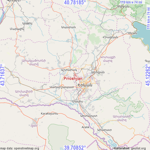
Prroshyan GPS coordinates[2]
40° 14' 50.316" North, 44° 25' 10.164" East
| Map corner | latitude | longitude |
|---|---|---|
| Upper-left | 40.78185°, | 43.71637° |
| Center: | 40.24731°, | 44.41949° |
| Lower-right: | 39.70852°, | 45.12262° |
| Map W x H: | 119.3×119.3 km | = 74.1×74.1mi |
| max Lat: | 41.24358° ⇑47.5% North |
| Prroshyan: | 40.24731° |
| min Lat: | ⇓52.5% South 38.90292° |
| min Long | Prroshyan | max Long |
| 43.74722° | 44.41949° | 46.5446° |
| W 40.8%⇐ | ⇒59.2% E |
Elevation
Elevation of Prroshyan is 1185 m = 3888 ft, and this is 116.5 m = 382 ft below average elevation for this country.
| Max E: |
2169 m = 7116 ft | 54.8% |
| Avg. | 1301.5 m = 4270 ft | |
| Prroshyan | 1185 m = 3888 ft | |
Min E: |
440 m = 1444 ft | 45.2% |
See also: Armenia elevation on elevation.city.
Geographical zone
Prroshyan is located in North temperate zone (between Tropic of Cancer and the Arctic Circle). Distance of this Northern Tropic circle is 1869.2 km =1161.5 mi to South.| Distance of | km | miles | from Prroshyan |
|---|---|---|---|
| North Pole | 5532 | 3437.4 | to North |
| Arctic Circle | 2926.1 | 1818.2 | to North |
| Tropic Cancer | 1869.2 | 1161.5 | to South |
| Equator | 4475.1 | 2780.7 | to South |


Nearby cities:
15 places around Prroshyan: (largest is in red/bold)
• Argavand
10.6 km =6.6 mi,  171°
171°
• Ashtarak
7.5 km =4.7 mi,  319°
319°
• Aygek
7.1 km =4.4 mi,  203°
203°
• Baghramyan
7.2 km =4.5 mi,  215°
215°
• Karbi
9.9 km =6.2 mi,  339°
339°
• K’anak’erravan
9.8 km =6.1 mi,  89°
89°
• Merdzavan
7.5 km =4.7 mi,  192°
192°
• Musalerr
10.8 km =6.7 mi, 199°
• Nor Yerznka
6.4 km =4 mi, 336°
• Norakert
8.1 km =5 mi,  226°
226°
• Oshakan
8.9 km =5.5 mi,  281°
281°
• Ptghunk’
10.4 km =6.5 mi,  206°
206°
• Sasunik
6.4 km =4 mi,  272°
272°
• Voskevaz
10.6 km =6.6 mi,  286°
286°
• Yeghvard
10.3 km =6.4 mi,  33°
33°
Sources, notices
• [Note1] Compared only with cities in Armenia existing in our database
• [Src1] Map data: © OpenStreetMap contributors (CC-BY-SA)
• [Src2] Other city data from geonames.org with taken over terms of usage.
• [Src3] Geographical zone / Annual Mean Temperature by Robert A. Rohde @ Wikipedia
