Nor Geghi geodata
Nor Geghi (Kotayk) is a populated place; located in Armenia in Asia/Yerevan (GMT+4) time zone. With population of 4,896 people, there are 45 cities with bigger population in this country. Compared to other cities in Armenia, 60.5% of cities are located further ↓South; 54.5% of cities are located further ←West and 50% of cities have lower elevation than Nor Geghi. Note1


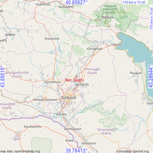
Nor Geghi GPS coordinates[2]
40° 19' 20.388" North, 44° 34' 59.916" East
| Map corner | latitude | longitude |
|---|---|---|
| Upper-left | 40.85627°, | 43.88019° |
| Center: | 40.32233°, | 44.58331° |
| Lower-right: | 39.78413°, | 45.28644° |
| Map W x H: | 119.2×119.2 km | = 74.1×74.1mi |
| max Lat: | 41.24358° ⇑39.5% North |
| Nor Geghi: | 40.32233° |
| min Lat: | ⇓60.5% South 38.90292° |
| min Long | Nor Geghi | max Long |
| 43.74722° | 44.58331° | 46.5446° |
| W 54.5%⇐ | ⇒45.5% E |
Elevation
Elevation of Nor Geghi is 1313 m = 4308 ft, and this is 11.5 m = 38 ft above average elevation for this country.
| Max E: |
2169 m = 7116 ft | 50% |
| Nor Geghi | 1313 m 4308 ft | |
| Avg. | 1301.5 m = 4270 ft | |
Min E: |
440 m = 1444 ft | 50% |
See also: Armenia elevation on elevation.city.
Geographical zone
Nor Geghi is located in North temperate zone (between Tropic of Cancer and the Arctic Circle). Distance of this Northern Tropic circle is 1877.5 km =1166.6 mi to South.| Distance of | km | miles | from Nor Geghi |
|---|---|---|---|
| North Pole | 5523.6 | 3432.2 | to North |
| Arctic Circle | 2917.8 | 1813 | to North |
| Tropic Cancer | 1877.5 | 1166.6 | to South |
| Equator | 4483.4 | 2785.9 | to South |


Nearby cities:
15 places around Nor Geghi: (largest is in red/bold)
• Abovyan
6.9 km =4.3 mi,  141°
141°
• Aragyugh
9.5 km =5.9 mi,  339°
339°
• Argel
6.3 km =3.9 mi,  12°
12°
• Arzni
3.1 km =1.9 mi,  154°
154°
• Balahovit
8.2 km =5.1 mi,  164°
164°
• Byureghavan
1.2 km =0.7 mi, 136°
• Kaputan
9.9 km =6.2 mi,  88°
88°
• Kotayk’
8.4 km =5.2 mi,  125°
125°
• K’anak’erravan
9.3 km =5.8 mi,  206°
206°
• Mayakovski
9 km =5.6 mi, 148°
• Mrgashen
5.2 km =3.2 mi,  219°
219°
• Nor Gyugh
8.9 km =5.5 mi, 134°
• Ptghni
7.4 km =4.6 mi,  178°
178°
• Yeghvard
8.2 km =5.1 mi,  272°
272°
• Zoravan
6.4 km =4 mi,  305°
305°
Sources, notices
• [Note1] Compared only with cities in Armenia existing in our database
• [Src1] Map data: © OpenStreetMap contributors (CC-BY-SA)
• [Src2] Other city data from geonames.org with taken over terms of usage.
• [Src3] Geographical zone / Annual Mean Temperature by Robert A. Rohde @ Wikipedia
