Nor Armavir geodata
Nor Armavir (Armavir) is a populated place; located in Armenia in Asia/Yerevan (GMT+4) time zone. With population of 1,597 people, there are 212 cities with bigger population in this country. Compared to other cities in Armenia, 70.4% of cities are located further ↑North; 90.1% of cities are located further →East and 67.5% of cities have higher elevation than Nor Armavir. Note1


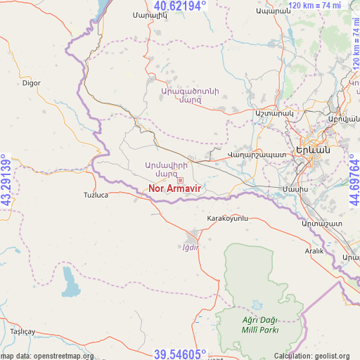
Nor Armavir GPS coordinates[2]
40° 5' 10.032" North, 43° 59' 40.236" East
| Map corner | latitude | longitude |
|---|---|---|
| Upper-left | 40.62194°, | 43.29139° |
| Center: | 40.08612°, | 43.99451° |
| Lower-right: | 39.54605°, | 44.69764° |
| Map W x H: | 119.6×119.6 km | = 74.3×74.3mi |
| max Lat: | 41.24358° ⇑70.4% North |
| Nor Armavir: | 40.08612° |
| min Lat: | ⇓29.6% South 38.90292° |
| min Long | Nor Armavir | max Long |
| 43.74722° | 43.99451° | 46.5446° |
| W 9.9%⇐ | ⇒90.1% E |
Elevation
Elevation of Nor Armavir is 888 m = 2913 ft, and this is 413.5 m = 1357 ft below average elevation for this country.
| Max E: |
2169 m = 7116 ft | 67.5% |
| Avg. | 1301.5 m = 4270 ft | |
| Nor Armavir | 888 m = 2913 ft | |
Min E: |
440 m = 1444 ft | 32.5% |
See also: Armenia elevation on elevation.city.
Geographical zone
Nor Armavir is located in North temperate zone (between Tropic of Cancer and the Arctic Circle). Distance of this Northern Tropic circle is 1851.2 km =1150.3 mi to South.| Distance of | km | miles | from Nor Armavir |
|---|---|---|---|
| North Pole | 5549.9 | 3448.5 | to North |
| Arctic Circle | 2944 | 1829.3 | to North |
| Tropic Cancer | 1851.2 | 1150.3 | to South |
| Equator | 4457.2 | 2769.6 | to South |


Nearby cities:
15 places around Nor Armavir: (largest is in red/bold)
• Alashkert
5.3 km =3.3 mi,  64°
64°
• Arevik
8.6 km =5.3 mi,  79°
79°
• Argavand
8.9 km =5.5 mi,  108°
108°
• Armavir
8.5 km =5.3 mi,  26°
26°
• Aygeshat
5.8 km =3.6 mi,  102°
102°
• Bambakashat
3.3 km =2.1 mi,  40°
40°
• Getashen
6.5 km =4 mi,  224°
224°
• Janfida
5.4 km =3.4 mi,  148°
148°
• Lenughi
5.1 km =3.2 mi,  329°
329°
• Mrgashat
8.8 km =5.5 mi, 55°
• Nalbandyan
2.5 km =1.6 mi,  190°
190°
• P’shatavan
8.1 km =5 mi,  130°
130°
• Sardarapat
5.3 km =3.3 mi,  14°
14°
• Shenavan
6.4 km =4 mi,  237°
237°
• Tandzut
7.3 km =4.5 mi, 104°
Sources, notices
• [Note1] Compared only with cities in Armenia existing in our database
• [Src1] Map data: © OpenStreetMap contributors (CC-BY-SA)
• [Src2] Other city data from geonames.org with taken over terms of usage.
• [Src3] Geographical zone / Annual Mean Temperature by Robert A. Rohde @ Wikipedia
